|
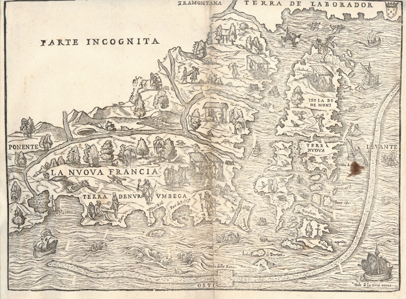
| Észak-Amerika keleti partvidékének fametszetű térképe New Yorktól a Szent Lőrinc-folyó torkolatáig. Giacomo Gastaldi készítette, Giovanni Battista Ramusio többkötetes útleírásában jelent meg, először 1556-ban Velencében. Paszpartuban. Mérete: 270 x 365 mm. |
| Wood cut map by Gastaldi, showing the eastern seaboard of the USA from New York Bay to the Gulf of St. Lawrence. Burden: 35. |
|
|
|
|