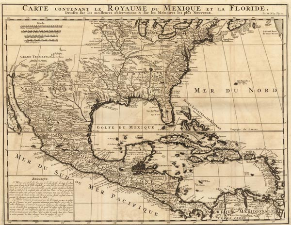
Carte contenant le Royaume du Mexique et la Floride…
1719 AmszterdamAuction 153 / 465.
Starting price: HUF 80 000ID
100607
Közép-Amerika Henri Abraham Chatelain által készített rézmetszetű térképe, amely Közép-Amerikát -- csendes-óceáni partvidékével együtt --, a Mexikói-öblöt, a Mississippi vízgyűjtőterületét (egészen a Nagy Tavakig), valamint Floridát mutatja be. A lap térképészetileg Guillaume Delisle "Carte du Mexique" című 1703-ban megjelent regionális ábrázolására támaszkodik, de a XVII. század végén végzett francia földrajzi kutatások eredményeit is tartalmazza. A cím a térképmező felett olvasható.
Map of Central America by Henri Abraham Chatelain, which also depicts the Gulf of Mexico, the Mississippi River Basin (up until the Great Lakes) as well as Florida. Cartographically, the sheet is based on Guillaume Delisle's "Carte du Mexique" (1703), but it also applies the results of French geographical researches carried out at the end of the 17th century.
Fine, clean copy.
Dimensions: 405 x 515 (435 x 555) mm.
Fine, clean copy.
Dimensions: 405 x 515 (435 x 555) mm.
Mérete: 405 x 515 (435 x 555) mm. Hibátlan, tiszta példány. Paszpartuban.
