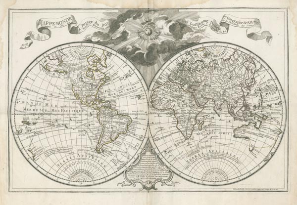
Mappemonde á l'usage du Roy Par Guillaume Delisle I.er Géographe de S.M. 1720. Augmentée en 1755 des Nouv(e)lles Decouvertes Par Philippe Buache...
AmszterdamAuction 155 / 176.
Starting price: HUF 150 000ID
100897
Guillaume de L'Isle rézmetszetű világtérképe, amely kettős félgömb alakú vetületen, korabeli határszínezéssel ábrázolja a kontinenseket. A lapot (amely először 1720-ban jelent meg) a térképész halála után veje — a szintén kartográfus Philippe Buache — átdolgozva bocsátotta közre. A térképmező fölötti rész közepét napkorong uralja, amelyen Anjou-liliomok láthatók, fölötte pedig korona lebeg. Az ezt övező felhőkből címszalagok tűnnek elő. Az alsó részen elhelyezett kartusban az impresszumadatok szerepelnek
Mérete: 440 x 670 (530 x 740) mm. A margón felül nagyobb méretű, kétoldalt kisebb vízfolttal. Paszpartuban.
World map by Guillaume de L'Isle depicting the continents on a double-hemisphere projection. Our item is revised and published by the cartographer's son-in-law, the famous French geographer, Philippe Buache.
Dimensions: 440 x 670 (530 x 740) mm. Original outline colour. Large water stain at the top and smaller ones on the two side-margins.
Dimensions: 440 x 670 (530 x 740) mm. Original outline colour. Large water stain at the top and smaller ones on the two side-margins.
