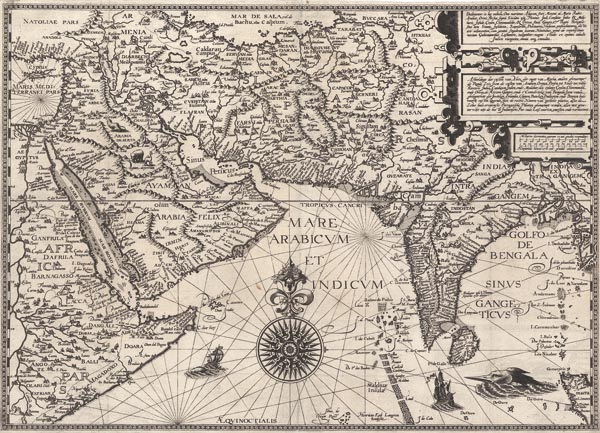
Deliniantur in hac tabula, Orae maritimae Abexiae, freti Mecani: al. Maris Rubri; Arabiae, Ormi, Persiae...
1596 AmszterdamAuction 143 / 177.
Starting price: HUF 800 000 Hammer price: HUF 800 000Dél-Ázsia Jan Huygen van Linschoten által készített rendkívül dekoratív, rézmetszetű portolántérképe (lásd árverésünk 175. tételét), amely egyike az Arab-tenger és az Indiai-óceán első nyomtatásban megjelent részletes navigációs lapjainak. A Vörös-tengertől a Bengáli-öbölig mutatja be a kontinens partvidékét, és pontosságát jellemzi, hogy az Arab-félsziget ábrázolása szinte azonos a modern térképekben megjelentekhez. A jobb felső sarokban található díszes, három részre osztott kartusban felül latinul, alatta pedig hollandul olvasható a bemutatott térségek felsorolása, amelyet a vonalas aránymérték megjelenítése követ. A metsző — Hendrik Florent van Langren — neve a Maldív-szigetektől balra, a lap alján olvasható. A kontinensek belseje kevésbé, de partvidékük a legnagyobb részletességgel van ábrázolva, legyen szó a Földközi-tenger közel-keleti végéről, a Vörös-tengerről, a Perzsa-öbölről vagy az Indiai-óceánról. A gazdagon illusztrált lapot készítője gyönyörű szélrózsával, tengeri és szárazföldi élőlényekkel, gályákkal és Delhi közelében pedig egy egyszarvúpárral díszítette.
Mérete: 395 x 545 mm.
Restaurált, erősen körülvágott példány. Paszpartuban.
Professionally restored copy with narrow margins.
Dimensions: 395 x 545 mm.
