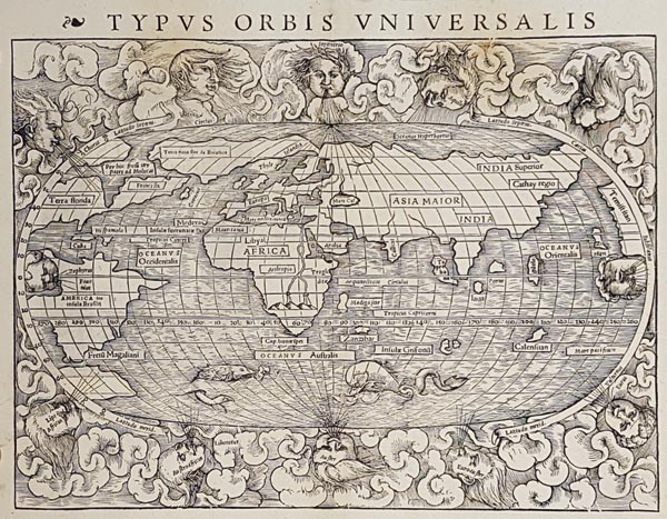
Typus Orbis Universalis
BaselAuction 145 / 164.
Starting price: HUF 250 000 Hammer price: HUF 550 000Sebastian Münster fametszetű világtérképe, amelyet — bár a korabeli "modern" világ reprezentációja — a "Geographia Universalis…" című Münster-féle Ptolemaiosz atlaszban, 1540-ben adtak közre először. Az ovális vetületen — amely Giovanni de Verrazzano és Jacques Cartier amerikai expedícióinak információi alapján készült — az amerikai kontinens alakja már felismerhető (a nyugati partvidék a jobb oldalra került), de Közép-Amerika körvonala nem látható tisztán. Az ismeretlen déli kontinens jelenléte sem erőteljes, inkább csak a Magellán-szoros kialakításánál ad neki szerepet az alkotó, aki elsőként tüntette fel a Csendes-óceán (Mare pacificum) megnevezést. Még a kor térképészei által leginkább ismert Európa alakja is kissé torz, és Grönland keskeny földnyelvvel kapcsolódik hozzá. Szembetűnő továbbá Délkelet-Ázsia kartográfiai bizonytalansága, hiszen a láthatólag aránytalanul kicsinek rajzolt Indiától keletre eső hatalmas Sri Lanka (Taprobana) partvonala inkább Szumátrára emlékeztet. A művész — David Kandel, aki a névbetűit csak munkája második állapotán tüntette fel — a térképmezőt 12 — felhők közül kibukkanó — szél-fejet ábrázoló keretbe foglalta, az ismeretlen déli óceánt pedig tengeri állatok illusztrációival tette mozgalmassá. A hátoldalon fametszetes díszítéssel övezett latin nyelvű magyarázó szöveg olvasható.
Mérete: 260 x 345 (290 x 375) mm. A példány felső részén (mindkét oldalon) enyhe barnás elszíneződéssel.
With some discolouration at the upper part (on both sides).
Dimensions: 260 x 345 (290 x 375) mm.
