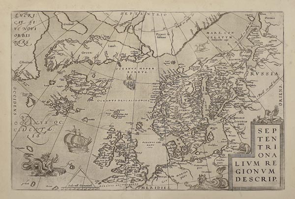
Septentrionalium Regionum Descrip.
1595 AntwerpenAuction 152 / 167.
Starting price: HUF 150 000ID
99717
Az Atlanti-óceán északi részének és az északi tengerek térségének korai térképe, amely Abraham Ortelius „Theatrum Orbis Terrarum” című híres munkájának 1595-ös, latin nyelvű kiadásában jelent meg. Amerika északi része, Grönland, Izland, Skandinávia és a Brit szigetek mellett olyan – a korabeli források (Zeno) által létezőnek hitt – mitikus szigeteket is ábrázol, mint Frisland, Drogeo és Icaria. Metszője, Frans Hogenberg a jobb alsó sarokban kartussal díszítette, a tengerek területén pedig gályákkal és tengeri szörnyekkel illusztrálta munkáját. A hátoldalon latin nyelvű magyarázó szöveg olvasható.
Early map of the northern part of the Atlantic Ocean and the northern seas published in the 1595 Latin edition of Abraham Ortelius’ „Theatrum Orbis Terrarum”. The map-field extends from North America to Scandinavia and depicts the British Isles, Greenland and Iceland as well as the mythical islands of Frisland, Drogeo and Icaria (from the Zeno map of 1558). The engraver, Frans Hogenberg added a cartouche containing the title of the map in the lower right corner and illustrated his work with several galleons and sea monsters. Latin text on the back.
Dimensions: 365 x 495 (445 x 555) mm. Fine, clear copy.
Dimensions: 365 x 495 (445 x 555) mm. Fine, clear copy.
Mérete: 365 x 495 (445 x 555) mm. Hibátlan, tiszta példány. Paszpartuban.
