
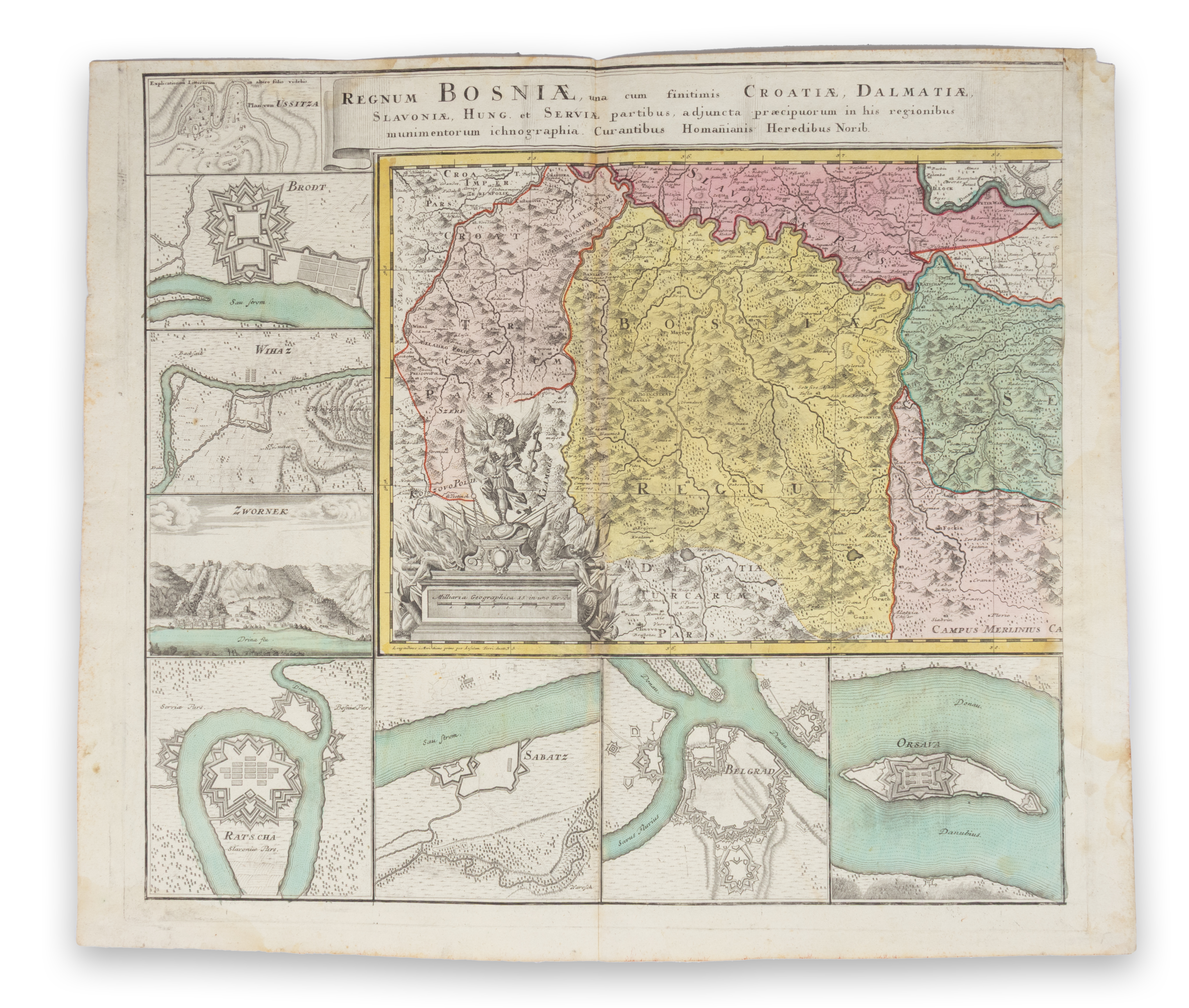
Regnum Bosniae, una cum finitimis Croatiae, Dalmatiae, Slavoniae, Hungariae et Serviae partibus, adjuncta praecipuorum in his regionibus munimentorum ichonographia. Regni Servia pars, una cum finitimis Valachiae, Bulgariae partibus, addita praecipuorum in his regionibus munimentorum et castellorum ichonographia.
Norimbergae, 1740. Homann Heredibus.Oettinger Boszniát, Szerbiát és a környező országokat ábrázoló nagyméretű térképe az 1718-as pozsareváci békét követően készült, amely az osztrákok és törökök közötti számos háború egyikét zárta le. A térkép a nevezett szerződés által rögzített új határvonalat mutatja be.
Az új határkijelölés értelmében az osztrák-török határ a Száva folyótól 6-10 kilométerrel délebbre tolódott, így a boszniai Poszavinát Szlavóniához, azaz a Habsburg Monarchiához csatolták. Szerbiában az új osztrák-török határ immár a Morava folyótól délre húzódott. A háborús hangulatot a térkép szélein elhelyezett katonai erődítmények alaprajzai tükrözik: Vidin, Nikápoly (Nikopolje), Niš, Čačak, Szarajevó, Kragujevac, Valjevo, Užice, Brod, Bihács (Bihać), Zvornik, Rača, Szabács (Šabac), Belgrád és Orsova.
Egyenként 64,5×55 cm
A középső hajtásoknál enyhe ragasztónyom, a jobb oldali részeken a képmezőbe is benyúló enyhe vízfoltokkal. Enyhén barnult.
Oettinger’s map of Bosnia, Serbia and the neighbouring countries was made after the Peace Treaty of Požarevac of 1718 that concluded one of many wars fought between the Austrians and the Turks. This map shows a new position of the border established by the said Treaty. By the new demarcation the Austrian –Turkish border was shifted 6-10 kilometres further south from the river Sava integrating the Bosnian Posavina into Slavonia, i.e., into the Hapsburg Monarchy. The new Austro-Turkish border in Serbia is now placed to the south of the river Morava. The war atmosphere is reflected by the plans of military fortresses shown along the map’s margin edge: Vidin, Nikopolje, Niš, Čačak, Sarajevo, Kragujevac, Valjevo, Užice, Brod, Bihać, Zvornik, Rača, Šabac, Beograd and Oršava.
Each approx. 64,5×55 cm
Centerfolds slightly shadowed by glue, water stains on the right sides extending somewhat into the image area. Lightly browned.