")
Szerző
Mercator, Gerard
Sclavonia, Croatia, Bosnia cum Dalmatiae Parte
Amsterdam, 1619. Hondius, Jodocus (ifj.)Ár
120 000 Ft
Azonosító
105277
A5 fiók
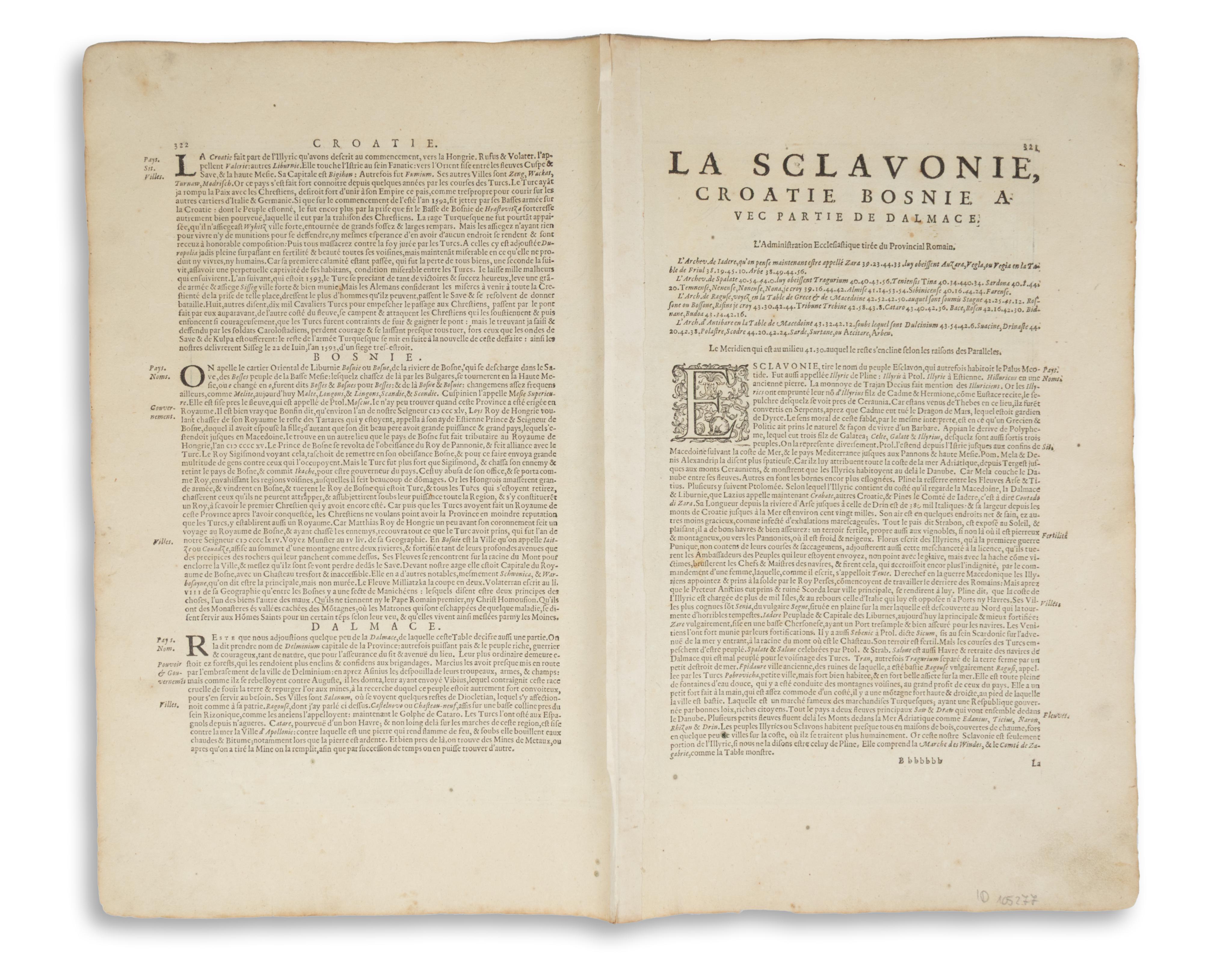
Mercator 1585-ös régiótérképe alapján készült rézmetszetű térkép. Díszes kartussal, a Mercator-Hondius Atlas korai, francia kiadásából.
Lapméret: 57×47 cm
Térkép mérete: 46×35,5 cm
A térkép a Balkán kelet-európai régióját ábrázolja, amely magában foglalja Szlavóniát, Horvátországot, Boszniát, a Velencei-öblöt balra lent, valamint Szerbia nyugati felét, a Dráva folyó északi partjától a Drina folyó déli szakaszáig, illetve a nyugati Ptujtól a keleti Belgrádig.
Jó állapotban. A verson francia szöveg, 322-321-os oldalszámok, "Bbbbbbb", a hajtás mentén megerősítve. Széles margókkal.
Koeman I, map 7601:1.1, ed. 1:113 (1619 Francia)
A map of former Yugoslavia. From the early French edition of Mercator-Hondius Atlas. Orig. copper-engraving after G. Mercator's map of the region from 1585. With ornamental title-cartouche.
Sheet size: 57×47 cm
Map size: 46×35,5 cm
llustrates the Eastern European region of the Balkans, encompassing Slavonia, Croatia, Bosnia, the Gulf of Venice in the lower left, and the western half of Serbia, from the northern banks of the Drava River to the southern reaches of the Drina River, and from Ptuj in the west to Belgrade in the east.
In good condition for its age. French text on the verso, page numbers 322-321, "Bbbbbbb", reinforced along the fold.
Koeman I, map 7601:1.1, ed. 1:113 (1619 French).