
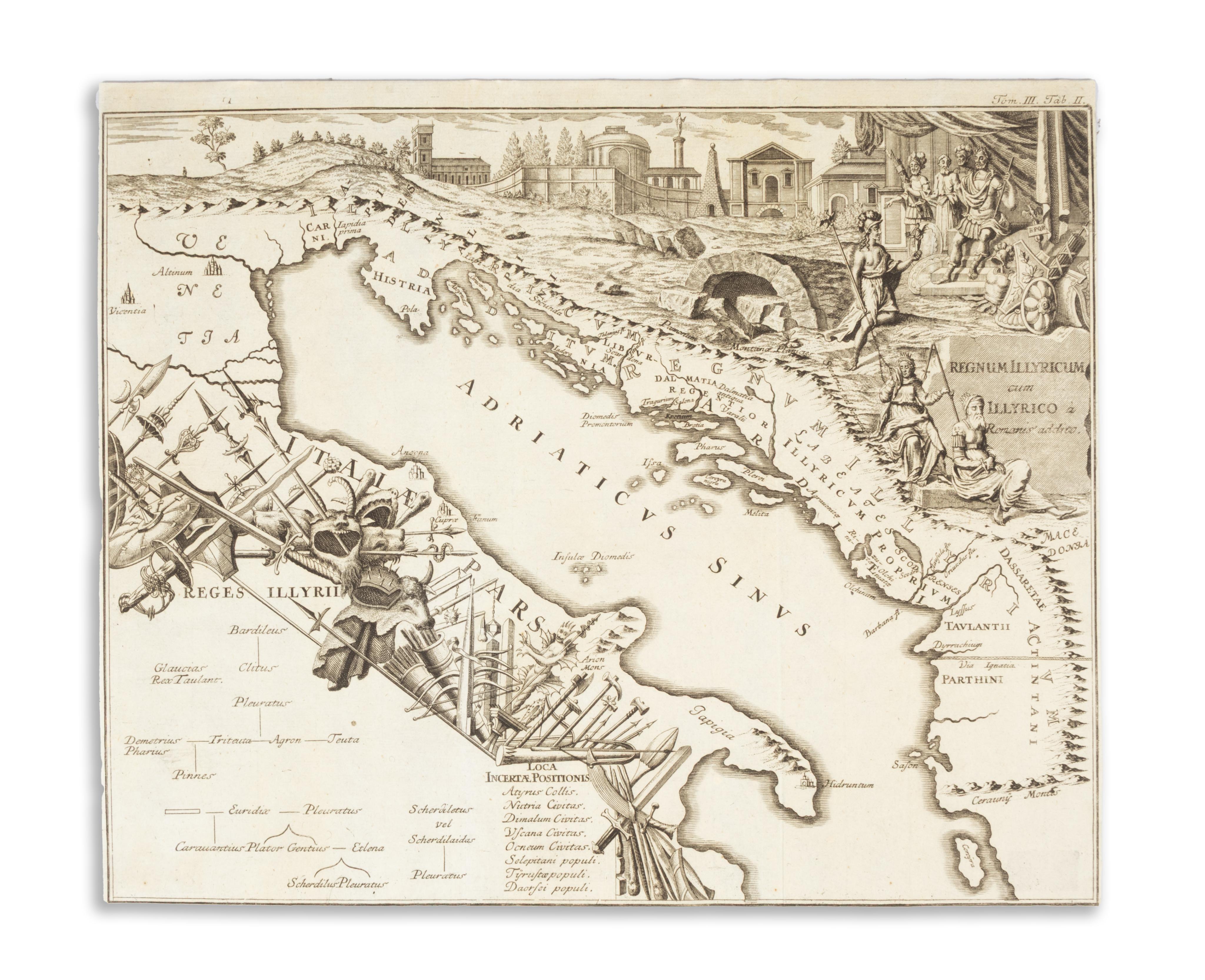
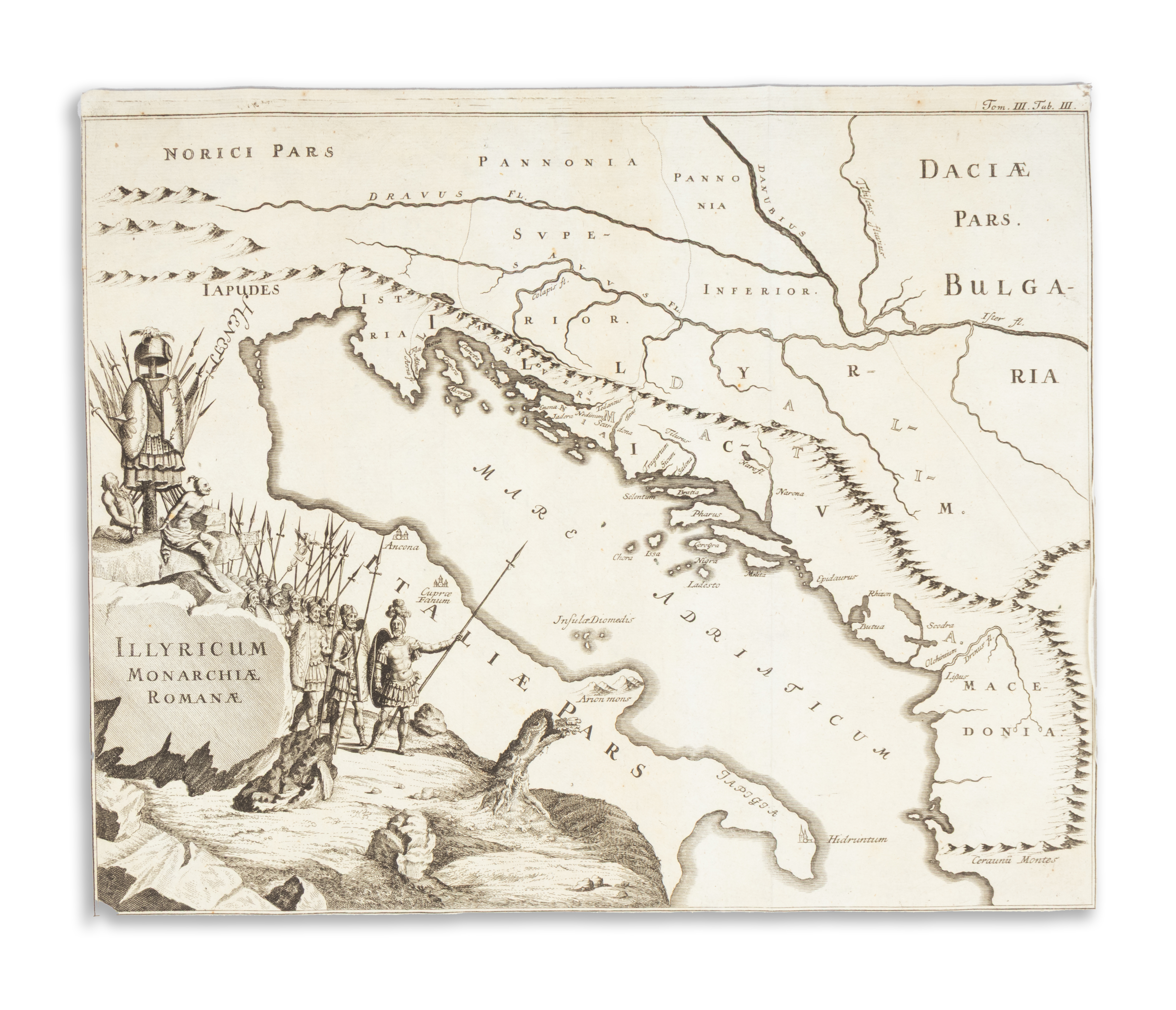
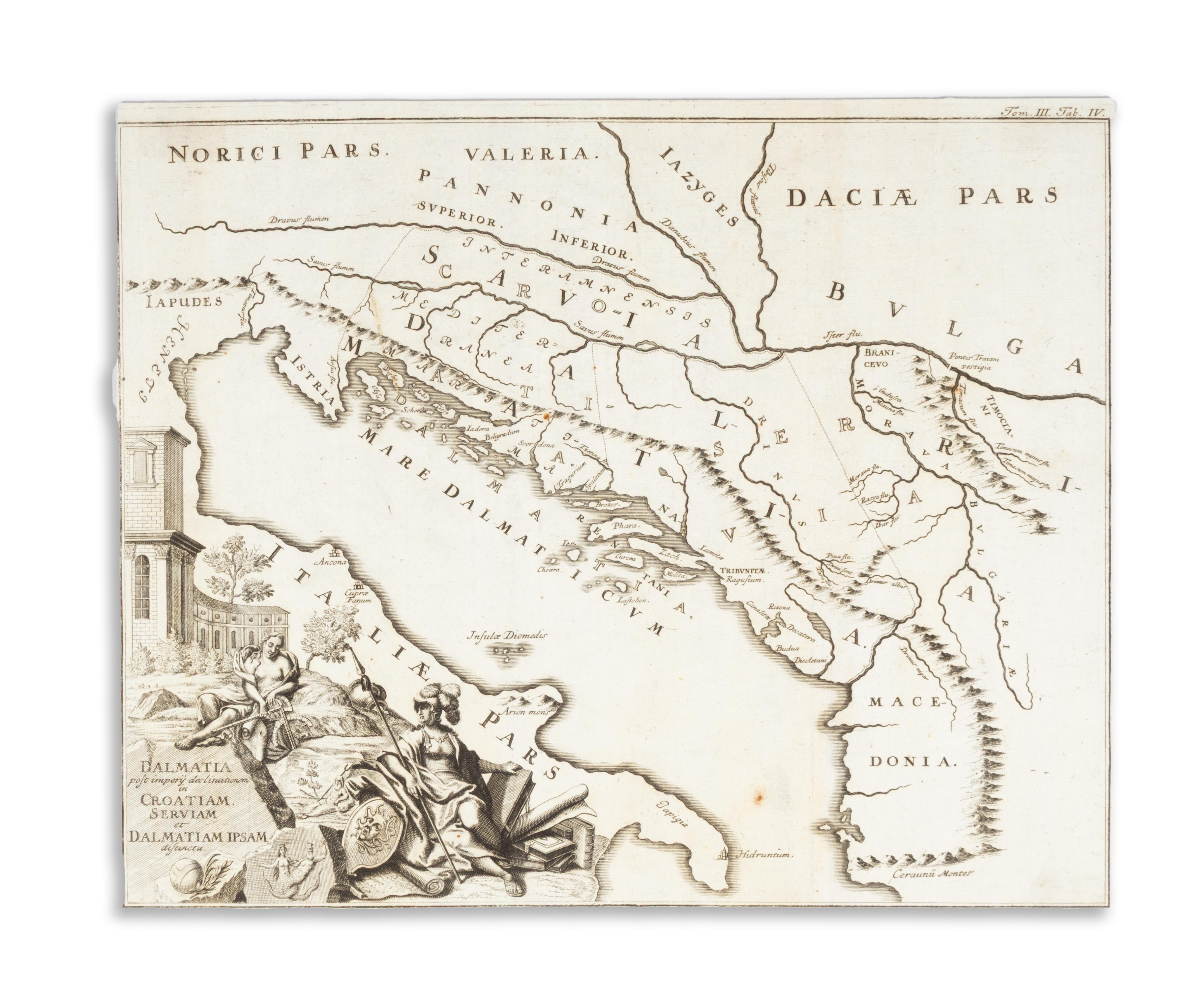
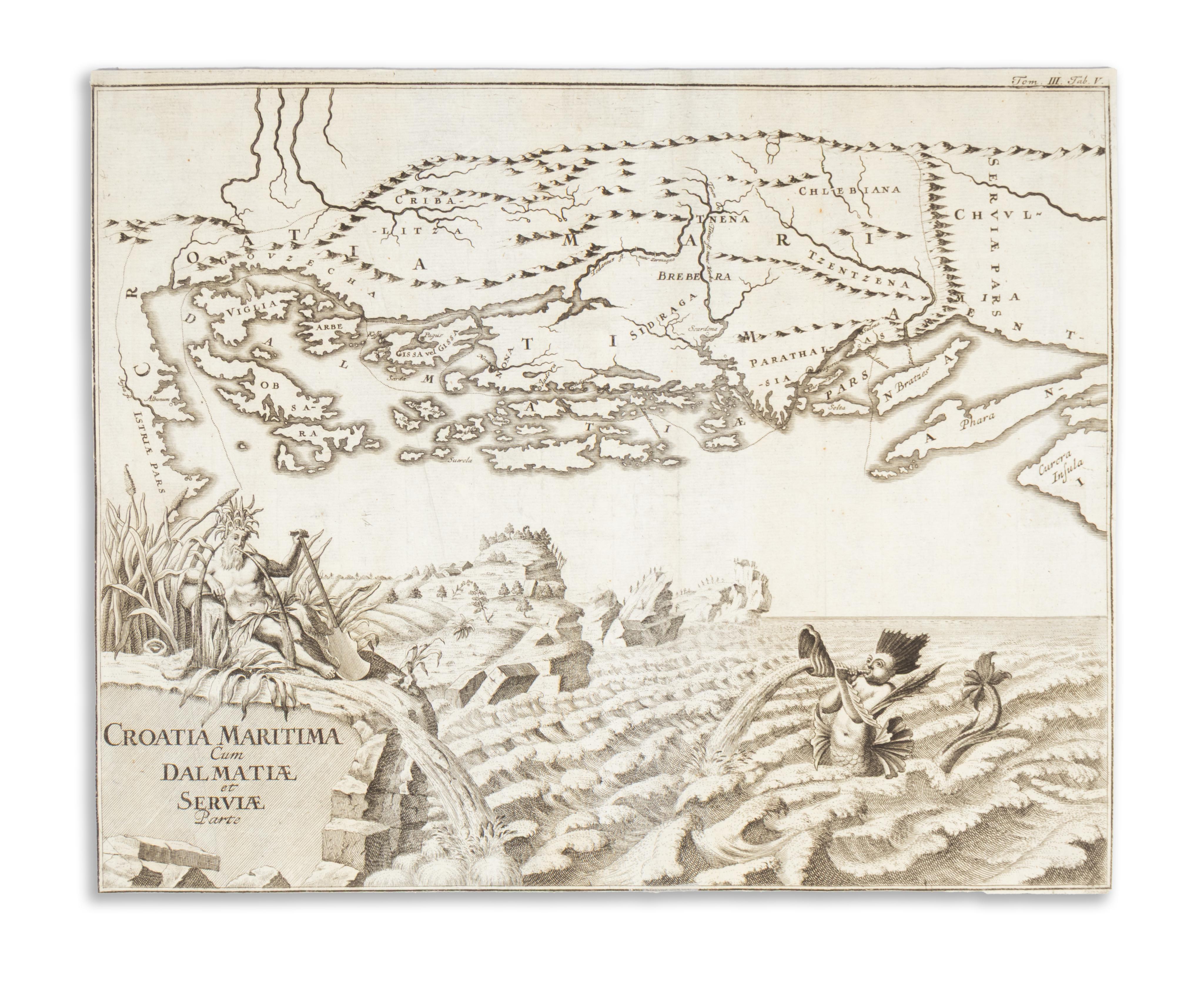
Öt rézmetszetű térkép a Scriptores rerum Hungaricarum veteres ac genuini... III. kötetéből
Vindobonensis, 1748. Johann Pauli Kraus.Az Adriai-tenger, a mai Horvátország, Szerbia, Dalmácia, Albánia és Koszovó, valamint az olasz partok egy részének öt rézmetszetű térképe. Tab I. Illyricum Antiquum. Tab. II.Regnum Illyricum cum Illyrico a Romanis addito. Tab. III. Illyricum Monarchiae Romanae. Tab. IV. Dalmatia post imperii declinationem in Croatiam, Serviam et Dalmatiam Ipsam distincta. Tab. V. Croatia maritima cum Dalmatiae et Serviae Parte.
Megjelent: Scriptores rerum Hungaricarum veteres ac genuini... cum amplissima praefatione Matthiae Belii, nec non instructissimo rerum verborumque indice, in nitidissimam hanc formam redacti. Cura et studio. Bécs, 1748. Tom. III. Tab. I.-V.
A magyar történeti irodalom egyik kiemelkedő alkotása, az első nagyszabású történelmi forrásgyűjtemény harmadik kötete horvát-szlavón-dalmát krónikákat tartalmaz. A munkát nagyméretű, dekoratív térképek ékesítik. Az osztrák történész szerző Bél Mátyás tanítványa volt. Utóbbi nevéhez fűződik az előszó, és nyilván segített a kötet összeállításában is. A harmadik kötet hatodik, az egész régiót ábrázoló térképe (Tab VI.) megtalálható kínálatunkban.
A térképmetszetek mindegyike gazdagon illusztrálva allegorikus alakokkal, fegyverekkel és épületekkel, hajókkal és képzeletbeli tengeri szörnyekkel. M: 36×30 cm. Kartonra kasírozva,megkímélt állapotban.
Tab I. Illyricum Antiquum. Tab II. Regnum Illyricum cum Illyrico a Romanis addito. Tab III. Illyricum Monarchiae Romanae. Tab IV. Dalmatia post imperii declinationem in Croatiam, Serviam et Dalmatiam Ipsam distincta. Tab V. Croatia maritima cum Dalmatiae et Serviae Parte
Published in: Scriptores rerum Hungaricarum veteres ac genuini... cum amplissima praefatione Matthiae Belii, nec non instructissimo rerum verborumque indice, in nitidissimam hanc formam redacti. Cura et studio. Vienna, 1748. Volume III. Tables I–V.
One of the outstanding works of Hungarian historical literature, the third volume of the first large-scale collection of historical sources contains Croatian-Slavonian-Dalmatian chronicles. The work is adorned with large, decorative maps. The Austrian historian who authored the volume was a student of Mátyás Bél, whose name is associated with the preface and who likely assisted in compiling the volume.
The sixth map of the third volume (Tab VI), depicting the entire region, is also available in our collection.
Each of the map engravings is richly illustrated with allegorical figures, weapons, buildings, ships, and imaginary sea monsters. Mounted on cardboard, in well-preserved condition. Size: 36 × 30 cm.