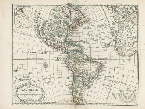
Carte D'Amerique, dressée pour l'usage du Roy.
1780 PárizsAuction 155 / 177.
Starting price: HUF 100 000Guillaume de L'Isle rézmetszetű Amerika-térképe, amely korabeli határszínezéssel ábrázolja a kontinenst. A lapot (amely először 1722-ben jelent meg) a térképész halála után veje, Philippe Buache 1763-ban kiegészítette, és újra kiadta. Példányunk ennek az 1780-ban módosított változata, amelyhez a bal felső sarokba — Vitus Jonassen Bering és Alekszej Csirikov útjának eredményeit felhasználva — Amerika északnyugati részének melléktérképét csatolták. Az átdolgozó az örökös, Jean Nicholas Buache lehetett — ahogy a kartus melletti szövegrész (Corrigée et Augmentée par M. Buache en 1780.) említi —, mert Jean-Claude Dezauche — akinek abban az évben átadta a térképek jogait — a következő publikáció alkalmával ezt az információt törölte, valamint a melléktérképet és a kartust is módosította.
Mérete: 490 x 615 (545 x 770) mm. A margón felül nagyobb méretű, kétoldalt kisebb vízfolttal. Paszpartuban.
Dimensions: 490 x 615 (545 x 770) mm. Original outline colour. Light discolouring around the edges, some small stains on the margin.
