Nouvelle Carte De L'Amerique Septentrionale Dressee Sur Les Plus Nouvelles Observations…
1710 AmsterdamElső megjelenés/First published in: Atlas Historique (1705-1720).
Méret/Size (margók nélkül/without margins): 47×59 cm
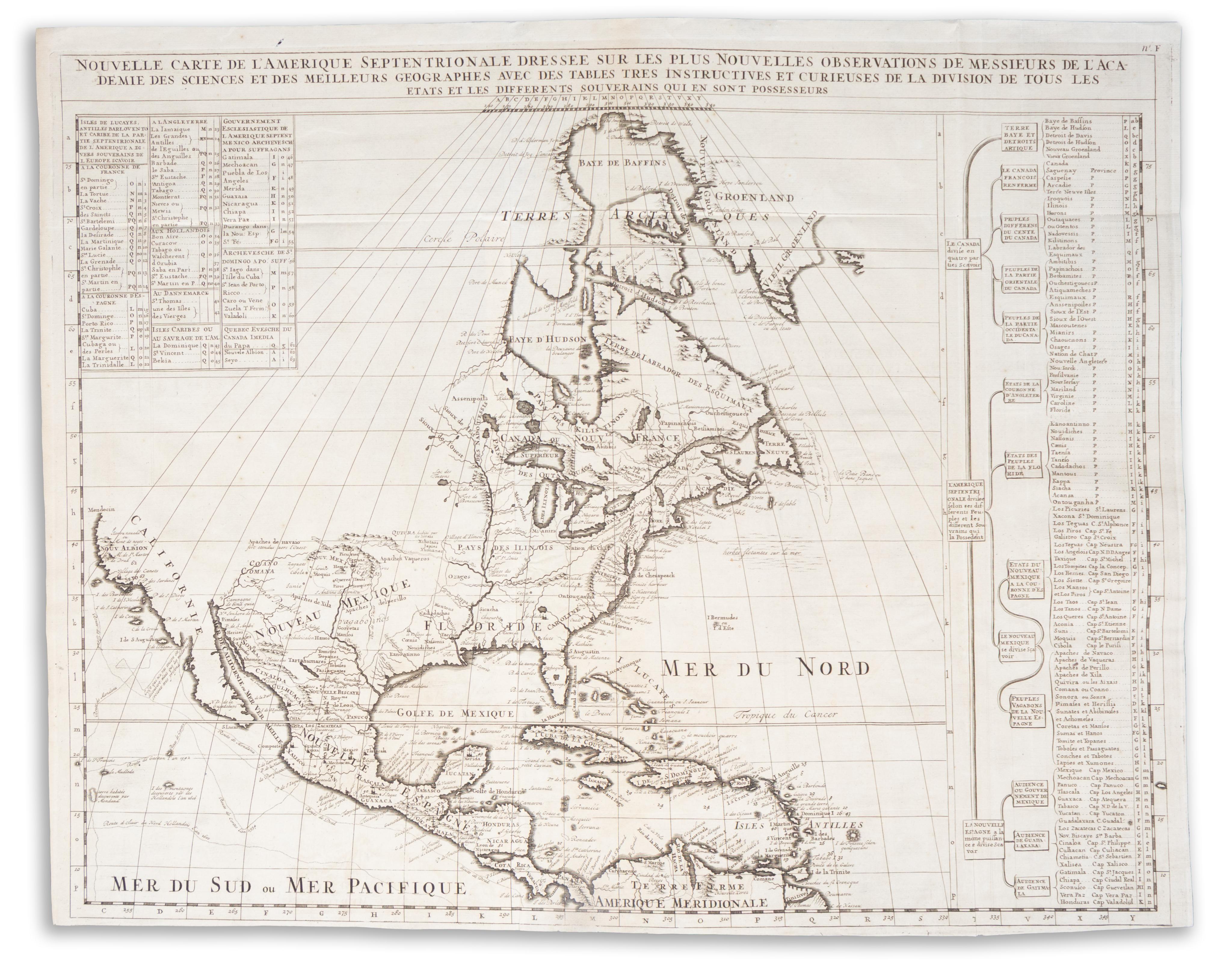
Észak-Amerika lenyűgöző térképe, amely De L'Isle 1700-as, nagy hatású térképén alapul, amely Chatelain monumentális, hétkötetes, Amszterdamban kiadott Atlas Historique című művében szerepel.
A térkép szinuszos vetületet használ a Föld görbületének ábrázolására. A térképen települések és városok, indiánok területei, tavak, folyók és hegyek láthatók. Kalifornia félszigetként van ábrázolva, falvakkal, hegyvonulatokkal és a Csatorna-szigetekkel. A Mississippi folyó messze túlnyúlik valódi forrásán, míg Florida túlméretezettnek tűnik, az angol gyarmatok pedig alulértékeltek. Az északnyugati rész üresen marad. A Csendes-óceánon különböző felfedezők útvonalai és feljegyzései jelennek meg. A térkép két táblázatot is tartalmaz, az egyik az egyes érdekes területek felkutatását segíti, a másik pedig Kanada, Amerika és Mexikó kisebb területekre való további felosztását.
Ez a kivételes térkép jól példázza Chatelain úttörő munkásságát, amely ügyesen ötvözi a kiterjedt földrajzi részleteket a kifinomult metszettel és a letisztult, elegáns dizájnnal. A francia térképészet aranykorának egyik legjobb példája.
Restaurált, színezetlen, szép példány. Vízjellel. Versója üres, a hajtás mentén megerősítve.
The map uses sinusoidal projection to represent the curvature of the earth. It shows settlements and cities, Native American land, lakes, rivers, and mountains.
California is depicted as a peninsula, complete with villages, mountain ranges, and the Channel Islands. The Mississippi River is shown extending far beyond its true source, while Florida appears oversized, and the English colonies are understated.
The north west is left blank. Routes and notes on various explorers appear in the Pacific Ocean. The map includes two tables, one which aids in locating specific areas of interest, the other further divides Canada, America, and Mexico into their smaller territories.
This exceptional map exemplifies Chatelain's groundbreaking work, skillfully blending extensive geographical detail with refined engraving and a clean, elegant design. It stands as a prime example of the golden age of French cartography.
Restored, uncolored, nice copy. With watermark. Blank verso, reinforced along the fold.
