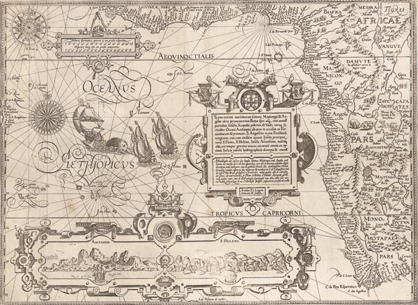
Typus orarum maritimarum Guineae, Manicongo, & Angolae ultra promontorium Bonae...
1596 AmszterdamAuction 143 / 176.
Starting price: HUF 600 000 Hammer price: HUF 600 000Dél-Afrika nyugati részének Jan Huygen van Linschoten által készített ritka, rézmetszetű portolántérképe (lásd árverésünk előző tételét), amely egyike a XVI. századi térképészet leggazdagabban díszített darabjainak. A lap Guineától a Jóreménység-fokáig mutatja be a kontitens nyugati partvidékét, így előző tételünk kiegészítésének is tekinthetjük. A földrajzi nevek és a helységnevek esetén a portugál elnevezéseket használja, és részletgazdagsága, valamint pontossága ellenére feltüntette Monomotapát — a képzeletbeli "arany országot" — és fővárosát, Vigiti Magná-t. Középen, a díszes, megosztott kartusban — amelyet a Portugál címer "koronáz meg" — felül latinul, alatta pedig hollandul olvasható a bemutatott térségek felsorolása, amelyet a metsző — Arnold Florent van Langren — neve követ. A bal felső részen térképészeti mérőkörzővel ékesített kartusban vonalas aránymérték látható. A keret alsó részéhez kapcsolódó keretben Ascension és Szent Ilona szigetének nagyméretű látképe található. A csodaszépen illusztrált lapot készítője több — az irányvonalak metszéspontját jelölő — szélrózsával, tengeri és szárazföldi élőlényekkel, gályákkal és a "Zaire lacus"-nak nevezett tóba álmodott szirénekkel díszítette.
Mérete: 395 x 535 mm.
Restaurált, erősen körülvágott példány. Paszpartuban.
Professionally restored copy with narrow margins.
Dimensions: 395 x 535 mm.
