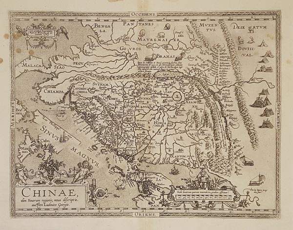
Chinae, olim Sinarum regionis, nova descriptio.
1592 AntwerpenAuction 145 / 169.
Starting price: HUF 700 000Kína rézmetszetű, nyugat-keleti tájolású térképe, amely Abraham Ortelius Theatrum Orbis Terrarum című munkájának 1592-es, latin nyelvű kiadásában jelent meg. A lap Luis Jorge de Barbuda portugál kartográfus beszámolója, és az általa készített kéziratos térkép alapján készült, és megjelenésének idején a régió legpontosabb nyomtatott ábrázolásának számított. A gazdagon illusztrált munka — amellett, hogy a térség egyik legkorábbi bemutatása — elsőként tüntette fel a Nagy Falat, és metszője őshonos állatokat, korabeli lakhelyeket és széllel hajtott közlekedési eszközöket is megörökített. A képen szembetűnő három díszes kartusban az uralkodói engedélyt, a mű címét és a vonalas aránymértéket találhatjuk. A hátoldalon olvasható latin nyelvű szövegben több kínai írásjelet is megjelenített a szerző.
Mérete: 365 x 475 (420 x 520) mm. A hajtásvonal mentén enyhe elszíneződéssel, a bal felső részen néhány folttal. Paszpartuban.
Slightly discoloured at centrefold and some staines near to the upper left corner.
Dimensions: 365 x 475 (420 x 520) mm.
