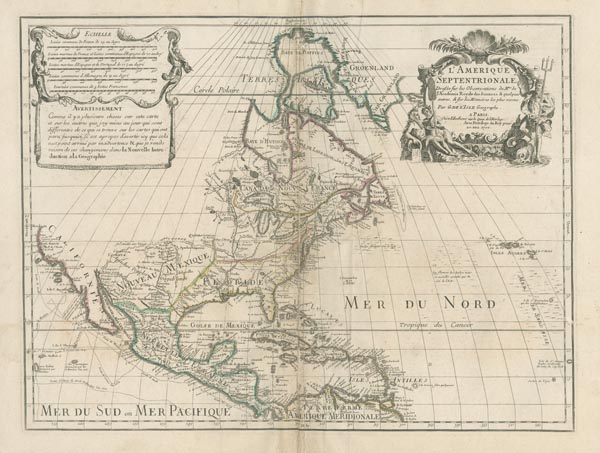
L'Amerique Septentrionale.
1708 Párizs155. árverés / 175.
Kikiáltási ár: 150 000 FtAzonosító
100884
Guillaume de L'Isle rézmetszetű, korabeli határszínezésű Észak-Amerika-térképe. Tételünk a térképész korai — elsőként 1700-ban kiadott — munkájának második állapota (már a Quai de l'Horloge szerepel rajta címként), kartográfiai mérföldkőként a kor legpontosabb — és legnagyobb hatású — Észak-Amerika-ábrázolását tárja elénk. A régió térképén megjelennek a francia utazók legfrissebb újvilági felfedezései, részletes névrajza pedig a településeken, a domborzati és vízrajzi elemeken túl jegyzeteket is tartalmaz.
Mérete: 455 x 600 (552 x 670) mm. A középső hajtás mentén több — helyenként javított — szakadással, felül két kisebb, szúrágás okozta lyukkal. Paszpartuban.
Map of North America by Guillaume de L'Isle published in 1708. Our item is the second state -- with the address Quai de l'Horloge -- of the historic and influential map, representing the most accurate cartography in 1700. The depiction of the region contains the French explorers' most recent information and a detailed nomenclature (with notes in addition to the settlements, topographic and hydrographic elements).
Dimensions: 455 x 600 (552 x 670) mm. Original outline colour. Several -- partly repaired -- tears along centrefold, two small wormholes in the upper centre.
Dimensions: 455 x 600 (552 x 670) mm. Original outline colour. Several -- partly repaired -- tears along centrefold, two small wormholes in the upper centre.
