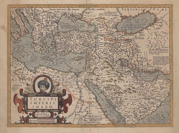
A Török Birodalom színezett, Jodocus Hondius által készített rézmetszetű térképe, amely elsőként az „Atlas sive cosmographicae meditationes...” című munkában jelent meg 1606-ban. A térképész a lap kartográfiai alapjául Gerard Mercator ábrázolását használta, miután 1604-ben megvásárolta a Mercator-atlasz nyomólemezeit és azok publikálásának jogát (ez élete legjövedelmezőbb döntésének bizonyult). A monumentális munka a XVII. század folyamán — számos nyelvre lefordítva — nagyjából 50 kiadást ért meg, amelyeket először ő, majd halála után fiai, és azt követően veje, Jan Jansson rendeztek sajtó alá. A finoman díszített kartus a bal alsó részen kapott helyet, amelyet a cím fölött III. Mehmed szultán arcképével egészített ki a metsző. Hátoldalán francia nyelvű szöveg található.
Mérete: 360 x 485 (455 x 540) mm. Néhány — a térképmezőt nem érintő — folttal és szúrágás nyomaival. Két kisebb — javított — szakadással (egy a térképmezőt is érinti). Paszpartuban.
Dimensions: 360 x 485 (455 x 540) mm. With some stains, which not affect the map field.
