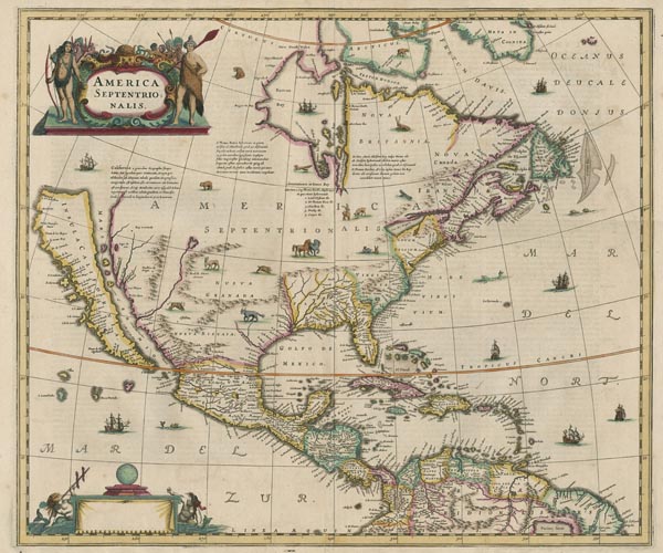
America Septentrionalis
1636 Amszterdam159. árverés / 177.
Kikiáltási ár: 900 000 FtÉszak-Amerika színezett, Henricus Hondius által készített, rézmetszetű térképe. A partvidék már kellően feltérképezett és pontos, azonban megjelenik a kor legnagyobb hatású földrajzi tévedése: Kalifornia szigetként történő ábrázolása. A nyugati területek kartográfiai alapját Henry Briggs 1625-ben kiadott Amerikája adta, a Mexikói-öböl és Florida esetében azonban Hessel Gerritsz munkáját használták, az északi területeket De Laet és Thomas James ihlette, illetve John Smith Virginia-térképének több helységneve is szerepel a lapon. A metsző a címmező díszes kartusát fegyveres bennszülöttek csoportjával vette körül, és a földrész őshonos állatainak vignettáival illusztrálta művét. Az óceánok területére tengeri szörnyek és gályák kerültek, az alsó kartus pedig üresen maradt (a következő kiadásokon Jan Jansson neve került bele). Hátoldalán francia nyelvű szöveg található.
Original coloured. With a small tear in the middle of the lower margin.
Dimensions: 470 x 555 (490 x 595) mm.
