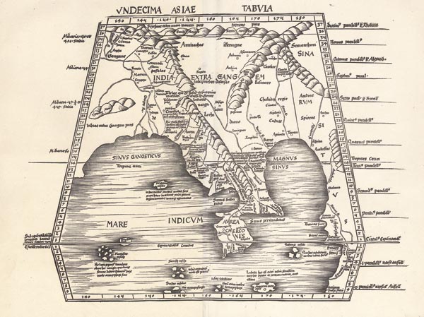
Undecima Asiae Tabula
Strassburg143. árverés / 168.
Kikiáltási ár: 500 000 Ft Leütési ár: 500 000 FtAzonosító
96194
Ritka, Délkelet-Ázsiát és a Bengáli-öblöt bemutató fametszetes térkép, amelyet Martin Waldseemüller "Geographiae opus novissima" című — Johannes Schott által Strassburgban megjelentetett — művében adtak közre. Eredetileg Nicolaus Germanus munkája és Waldseemüller Ptolemaiosz Geográfiájának 1482-es ulmi kiadásából emelte át saját atlaszába. A Waldseemüller-féle Geográfia első részének a tagja, amely 27 ptolemaioszi lapot tartalmaz (lásd előző tételünket). A metszet India Gangesztől keletre eső részét, Bangladest, Burmát és Kína nyugati részét ábrázolja.
Mérete: 375 x 430 (450 x 595) mm.
Tisztított példány. Paszpartuban.
Rare woodcut map representing Southeast Asia and the Bay of Bengal. Published in Martin Waldseemüller's "Geographiae opus novissima" (issued by Johannes Schott in Strasbourg). Originally, the design is Nicolaus Germanus's work and Waldseemüller incorporated it into his atlas from Ptolemy's Geographia (Ulm, 1482). It belongs to the first part of Waldseemüller's Geographia, which includes 27 Ptolemaian sheets (see our previous item). The map depicts the territory of India from the east of the Ganges to China's western part, including Bangladesh and Burma.
Cleaned copy.
Dimensions: 375 x 430 (450 x 595) mm.
Cleaned copy.
Dimensions: 375 x 430 (450 x 595) mm.
