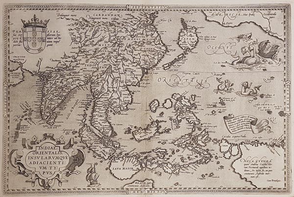
Indiae Orientalis Insularumque Adiacientium Typus
1592 Atwerpen145. árverés / 171.
Kikiáltási ár: 300 000 FtDélkelet-Ázsia, Japán és a Fülöp-szigetek rézmetszetű térképe, amely Abraham Ortelius Theatrum Orbis Terrarum című munkájának 1592-es, latin nyelvű kiadásában jelent meg. A lap Gerard Mercator 1569-es világtérképe alapján készült, Marco Polo beszámolóira támaszkodva. A metszeten helyet kapott Amerika nyugati része is, valamint felfedezhetőek a kor kartográfiai tévedései, így Szumátra, Jáva és Japán a ma ismerttől eltérő partvonala, és a szigetvilág hibás megjelenítése (amely a feltérképezés nehézségei miatt még évszázadokig változatlan maradt). Metszője a finoman kidolgozott kartuson kívül szépítkező hableányokkal, hajókkal és egy bálnatámadás ábrázolásával illusztrálta munkáját, a bal felső részen pedig a portugál címert helyezte el. Darabunkon — felül középen — a nyomólemez repedésének nyomai fedezhetők fel a "SEPTENTRIO" szóban található T és I betűknél. A hátoldalon latin nyelvű magyarázó szöveg olvasható.
Mérete: 350 x 495 (410 x 515) mm. A hajtásvonal alsó részén restaurálás nyomaival. Paszpartuban.
Slightly restored at the lower centrefold.
Dimensions: 350 x 495 (410 x 515) mm.
