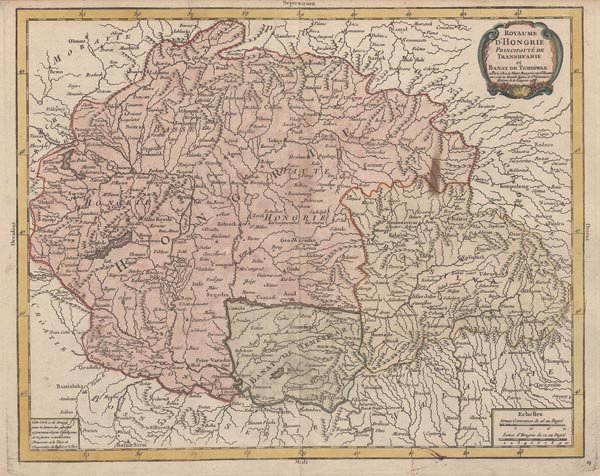
Royaume d'Hongrie Principauté de Transilvanie et Banat de Temeswar
1788 PárizsMásodik nap 148. árverés / 191.
Kikiáltási ár: 60 000 Ft Leütési ár: 60 000 FtAzonosító
98575
Pierre Bourgoin ritka, színezett Magyarország-térképe, amelyet a metsző és kiadó az „Atlas élémentaire de la géographie” művében adott ki, először 1765-ben. Példányunk az alkotó halála után, özvegye gondozásában jelent meg Párizsban, a kartusban a kiadó megváltozott címével és -- feltehetően a kiadás idejét jelző -- 1788-as évszámmal. A lapot kiegészítette még egy -- a bal alsó sarokba helyezett -- magyarázattal, amelyből kitűnik, hogy a munka egy -- az akkoriban folyó orosz-török háborúról szóló -- tudósítás mellékleteként láthatott napvilágot.
Mérete: 360 x 445 (370 x 500) mm. Paszpartuban.
A lap felső részén a nyomólemez széléig vágva, egy helyen kisebb folttal.
Pierre Bourgoin’s rare, coloured map of Hungary that first appeared in the “Atlas élémentaire de la géographie” in 1765. Our copy was published after the death of the creator with the help of his widow who changed the publisher’s title and probably marked the date of publishing by 1788. The sheet had been completed by an explanation in the bottom left corner, which notes that the map was issued as a supplement of the report about the on-going Russo-Turkish War.
With a small stain and narrow margins (especially at the top).
With a small stain and narrow margins (especially at the top).
