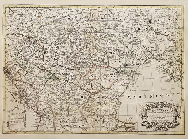
Jeremias Wolf által kiadott, ritka, határszínezett Magyarország-térkép, amely Guillaume de l’Isle munkája alapján készült. Metszője -- Matthäus Seutter -- a cím-mezőt a Fekete-tenger területén ábrázolt díszes kartusba foglalta, a bal alsó sarokba pedig -- ahol a neve is megjelenik -- vonalas aránymértéket helyezett. Szántai 1720 körülre tette a darab megjelenését, a nyomólemez azonban 1702 és 1707 között készülhetett, ugyanis Seutter csak rövid ideig dolgozott a kiadónak.
Mérete: 465 x 640 (520 x 695) mm. Paszpartuben
Rare, outline-coloured map of Hungary published by Jeremias Wolf based on Guillaume de l’Isle’s work. Its engraver -- Matthäus Seutter -- incorporated the title field in the ornate cartouche depicted on the area of the Black Sea and put a bar scale in the bottom left corner -- where his name also appears. Szántai estimated that the copy was issued around 1720, but the plate could have been made between 1702 and 1707 because Seutter had worked for the publisher only for a short time.
