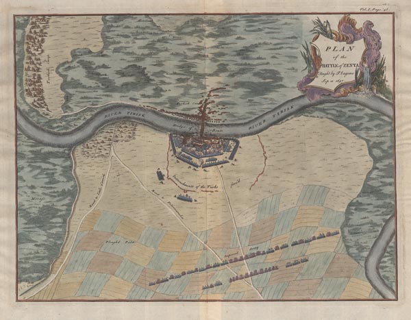
Plan of the Battle of Zenta
Második nap 148. árverés / 190.
Kikiáltási ár: 60 000 FtAz 1697. szeptember 11-i zentai csatáról készített színes térkép, amelyet Jean Dumont és Jean Rousset de Missy angol nyelvű (John Campbell által fordított), „The military history of the late Prince Eugene of Savoy, and of the late John Duke of Marlborough” címmel megjelent művének első kötetében adtak ki, először 1736-ban. A metsző -- Claude du Bosc -- nemcsak a várost és környékét ábrázolta, hanem a török és a Savoyai Jenő által vezetett szövetséges keresztény seregek állásait is feltüntette. A címmező a lap jobb felső részén, finoman díszített kartusban kapott helyet. Példányunk a hadtörténeti munka 1737 utáni kiadásának melléklete (az első változatnál az oldalszám még nem szerepelt).
Mérete: 345 x 450 (460 x 510) mm. Paszpartuban.
