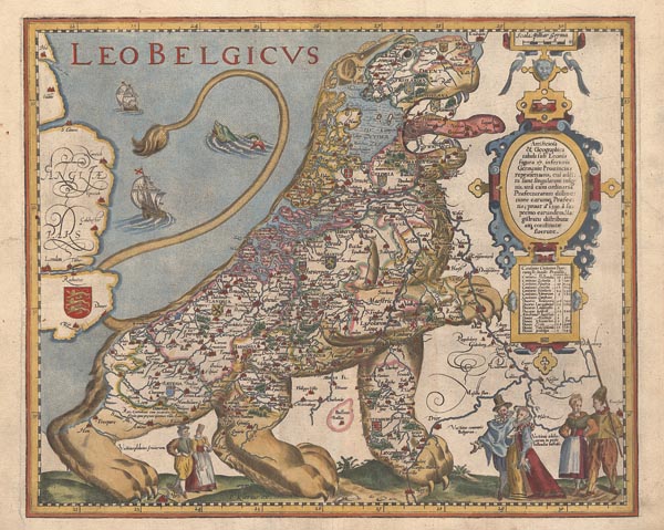
Belgium rendkívül ritka, oroszlán-alakban ábrázolt, korabeli színezésű térképe, amely a leghíresebb példája a nemzeti büszkeség kartográfiai kifejezésének. Pieter van den Keere „Germania Inferior…” című atlaszában jelent meg 1617-ben. Előképét Michaël Eytzinger alkotta meg – Frans Hogenberg segítségével – 1583-as, Németalföld függetlenségi háborújáról írott könyve, a „De Leone Belgico…” illusztációjaként. Metszője – Hendrik Floris van Langren – a 17 tartomány címerével, a három népcsoportot képviselő, jellegzetes fríz, holland és belga viseletbe öltözött párral, gályákkal, tengeri szörnnyel és nagy méretű, kettős kartussal díszítette a lapot, amit feltehetően Cornelis Claesz adott ki 1609 előtt (ennek a változatnak 2 példánya ismert). Halála után a nyomólemez van den Keere-hez került, aki a metsző nevét a sajátjára cserélte, megváltoztatta a keretdíszt és egy vonalas aránymértéket illesztett a meglévő kartusok fölé. A lap hátoldalán francia nyelvű szöveg található.
Tételünk – a 2., van den Keere-féle állapot levonata – egyike a legszebb és legismertebb térképlapoknak, amely bármely gyűj¬temény megbecsült darabja lehet.
Our item – a 2nd-state copy – is one of the most beautiful and well-known maps and it can be a valued piece of any collection.
Dimensions: 370 x 450 (410 x 500) mm. Fine, clear, coloured copy.

