

Szerző
Cantelli da Vignola
L’Ungaria nuouamente descritta, et accresciuta di Varie Notizie…
Roma, 1686, Gio. Giacomo de RossiÁr
HUF 650 000
ID
104811
A1 polc
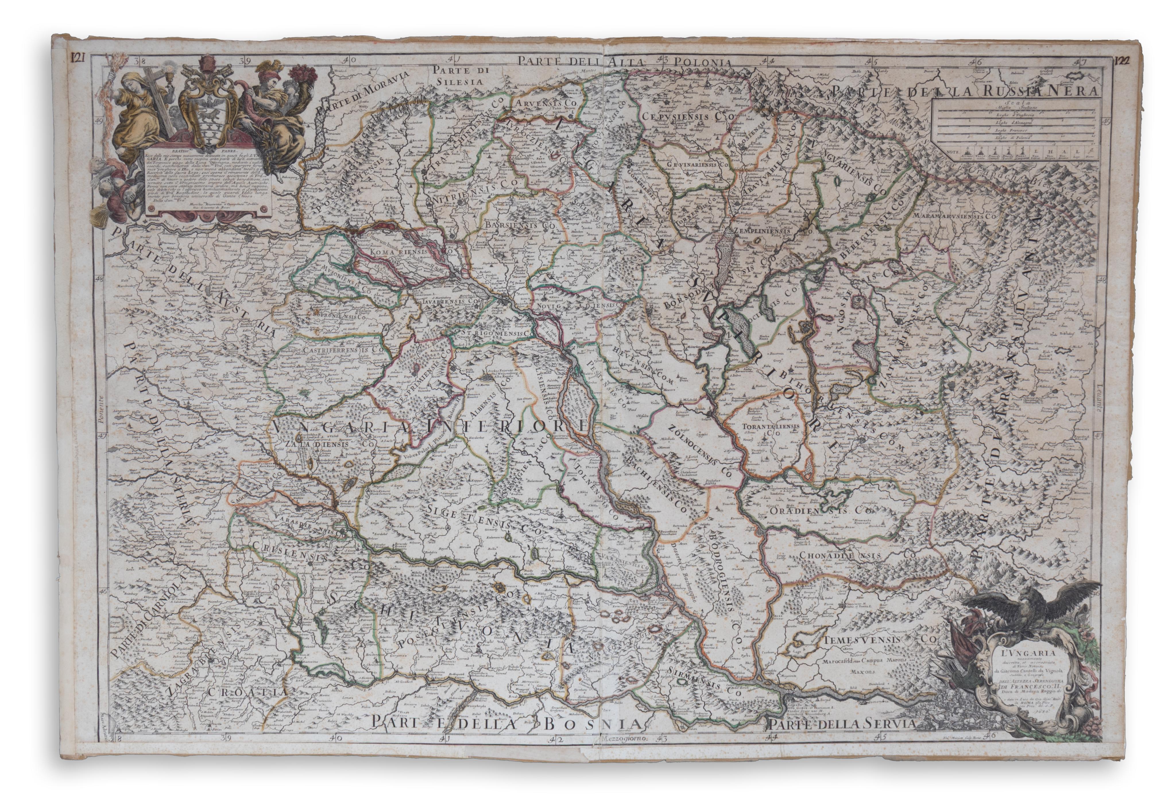
Magyarország térképe 1686-ban. Határszínezett rézmetszetű térkép két lapból összeillesztve. Készítette: Cantelli, da Vignola Giacomo. Kiadó: Roma. 1686. Gio. Giac.[omo] Rossi. Méretarány: 1:830 000. Ausztria keleti része, délen az Adriai tenger csücske, Nándorfehérvár, keleten Erdély, fent a Tátra vonulatáig mutat átfogó rajzot.
Lapméret: 93×62 cm. Két sarokrajzzal, fent allegorikus és vallási szimbólumokkal. A címkartusban sas, fegyverek, zászló, harcijelenet. A térképen pápának szóló ajánlással. Giacomo Giovanni Rossi "Mercurio geografico overo..." című atlaszában jelent meg Rómában,1692-94 ben.
Szántai: Rossi 4
Erősen rozsdapöttyös, szélein papírszalaggal megerősítve. Ennek ellenére is mutatós térkép.
Map of Hungary in 1686. Border-colored copperplate map. It shows the eastern part of Austria, the tip of the Adriatic Sea in the south, Nándorfehérvár, Transylvania in the east, and the Tatra Mountains in the top.
Sheet size: 93×62 cm. With two corner drawings, allegorical and religious symbols at the top. In the title cartouche an eagle, weapons, flag, battle scene.
Heavily rust-stained, reinforced with paper tape at the edges. Nevertheless, a striking map.
Sheet size: 93×62 cm. With two corner drawings, allegorical and religious symbols at the top. In the title cartouche an eagle, weapons, flag, battle scene.
Heavily rust-stained, reinforced with paper tape at the edges. Nevertheless, a striking map.