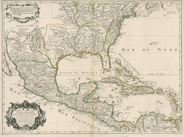
Carte du Mexique et de la Floride des Terres Angloises et des Isles Antilles du Cours et des Environs de la Riviere Mississipi…
Párizs között155. árverés / 174.
Kikiáltási ár: 200 000 FtA Mexikói-öböl rézmetszetű, önálló lapként megjelent térképe, amely korabeli határszínezéssel ábrázolja a Nagy Tavaktól délre eső területet, egészen Dél-Amerika északi partvidékéig. Guillaume de L'Isle kartográfiai mérföldkőként a kor legpontosabb — és legnagyobb hatású — Amerika-ábrázolását tárja elénk. Mint udvari főtérképész, hozzáférése volt az aktuális kutatási eredményekhez, és ezeket összegyűjtve, metszetein megjelenítette korának legfrissebb felfedezéseit. A Mississippi völgyének és a Nagy Tavak vidékének pontos ábrázolásakor többek között a La Salle-expedíció túlélőinek beszámolóira, valamint spanyol és francia jezsuita misszionáriusok útjainak eredményeire és kéziratos térképvázlataira támaszkodott. A bal alsó sarokban elhelyezett, aprólékosan kidolgozott kartus a lap címét és az impresszum-adatokat tartalmazza (kiadási évként itt — az első levonat készítésének időpontja — 1703 jelenik meg), felül pedig növényi ornamensekkel illusztrált keretben vonalas aránymértékek szerepelnek.
Mérete: 475 x 640 (520 x 665) mm. A néhány kisebb folttal, a lap két oldalán enyhén, felül erősebben (a térképmezőt nem érintve) megvágva. Paszpartuban.
Dimensions: 475 x 640 (520 x 665) mm. Original outline colour. The side margins slightly, the upper one is more hardly cropped (the map field not affected). With some light stains.
