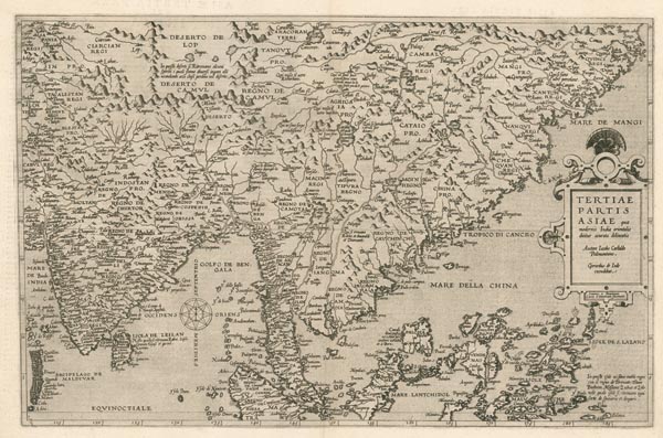
Tertiae Partis Asiae...
1578 Antwerpen159. árverés / 176.
Kikiáltási ár: 1 600 000 FtKelet-Ázsia ritka, Gerard de Jode által készített, rézmetszetű térképe, amely a „Speculum Orbis Terrae” című atlaszának első kiadásában jelent meg. Az ábrázolás Giacomo Gastaldi 1561-es négylapos munkája alapján készült. A térkép észak-déli irányban a Mongóliától a Fülöp-szigetekig terjedő, nyugatról keletre pedig a India és Kína közötti területet jeleníti meg. Névrajza – a kor biztosította lehetőségekhez képest – részletes, a kartográfiai hiányosságokat igyekeztek illusztrációkkal, domborzati elemekkel és nagyobb méretű betűtípusok használatával elfedni. A metszők – Jan és Lucas van Deutecum – finoman díszített kartussal és egy szélrózsával illusztrálták a lapot, amelynek hátoldalán latin nyelvű szöveg található.
Fine, clear copy.
Dimensions: 330 x 505 (390 x 550) mm.
