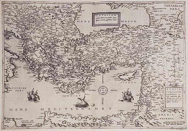
Natoliam moderni dicunt eam partem quam Asiam minorem appellauere veteres. / Turcia Turcicive Imperii seu Solii mannorum regni pleraque pars, nunt recens summa fide ac industria elucubrata.
1593 Antwerpen145. árverés / 167.
Kikiáltási ár: 450 000 FtAzonosító
96945
A Földközi-tenger keleti részét és Kis-Ázsiát ábrázoló rézmetszetű térkép, amelyet Gerard de Jode "Speculum Orbis Terrae" című atlaszának 1578-as kiadásában adtak közre először. Példányunk a Cornelis de Jode által publikált második kiadás részeként látott napvilágot. Metszője — Jan van Deutecum — a címmezőt két kartusban helyezte el (egyikben a földrajzi megnevezést, a másikban az ország nevét feltüntetve), és három aprólékosan kidolgozott gályával illusztrálta munkáját. A részletes névrajz elkészítése mellett gondja volt arra is, hogy Noé bárkáját megjelenítse az Ararát hegyén.
Mérete: 385 x 510 (415 x 545) mm. Hibátlan, tiszta példány. Paszpartuban.
Regional map of the Eastern Mediterranean and Asia Minor, first published in the 1578 edition of Gerard de Jode's "Speculum Orbis Terrae". Our copy is from the second issue, published by Cornelis de Jode. The engraver -- Jan van Deutecum -- placed two cartouches (one for the geographical identification and one for the title) and three fine detailed galleons to illustrate his work and besides the thorough nomenclature he depicted Noah's Ark on the top of Mount Ararat.
Fine, clear copy.
Dimensions: 385 x 510 (415 x 545) mm.
Fine, clear copy.
Dimensions: 385 x 510 (415 x 545) mm.
