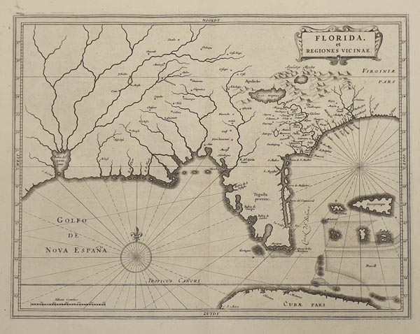
Florida, et Regiones Vicinae.
1633 Leiden152. árverés / 172.
Kikiáltási ár: 300 000 FtHessel Gerritsz által készített, ritka, rézmetszetű térkép, amely a Floridai-félszigetet és a környező régiót mutatja be. Johannes de Laet fő művének második – „Beschrijvinghe van West-Indien…” című – kiadásában jelent meg (lásd előző tételünket). Kulcsfontosságú térképészeti munka, a terület legkorábbi – gyűjtők számára is hozzáférhető – ábrázolásainak egyike. Kartográfiai alapjául Cornelis Claesz 1602-es munkája és Jacques le Moyne Florida-térképe szolgált, nomenklatúrájára pedig Geronimo Chaves volt hatással. Bár az alkotó számos korabeli forrást használt fel a térkép elkészítéséhez – előző tételünkkel ellentétben –, új információval nem gazdagította azt. Az egyetlen szokatlan megnevezés a félszigeten a „Tegesta provinc.”, amely az akkor őshonos indián törzsre utal. A munkát készítője a szárazföld belsejébe helyezett, növényi ornamensekkel díszített kartussal és egy szélrózsával illusztrálta.
The work is illustrated with a cartouche – laced with floral ornaments – and with a compass rose.
Dimensions: 285 x 360 (310 x 390) mm.Fine, clear copy.
