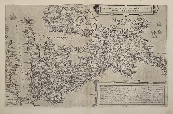
Angliae Scotiae et Hibernie Nova Descriptio.
1593 Antwerpen152. árverés / 161.
Kikiáltási ár: 300 000 FtAzonosító
99718
A Brit szigetek ritka – nyugat-keleti tájolású –, Gerard de Jode által készített rézmetszetű ábrázolása, amely a „Speculum Orbis Terrae” második kiadásában jelent meg. A lap Gerard Mercator 1564-es falitérképe alapján készült. A metsző illusztrációként gályákat és két finoman díszített kartust alkalmazott, amely közül az egyik a címmezőt, a másik pedig a terület rövid leírását tartalmazza. Hátoldalán latin nyelvű szöveg olvasható.
Rare map of the British Isles by Gerard de Jode, published in the second edition of de Jode’s „Speculum Orbis Terrae” in 1593. Based on Gerard Mercator’s 1564 wall map. The work is tastefully decorated with several galleons and two finely detailed cartouches (one for the title and the other for a small description of the region). Latin text on the back.
Dimensions: 350 x 500 (415 x 550) mm. Fine, clear copy.
Dimensions: 350 x 500 (415 x 550) mm. Fine, clear copy.
Mérete: 350 x 500 (415 x 550) mm. Hibátlan, tiszta példány. Paszpartuban.
