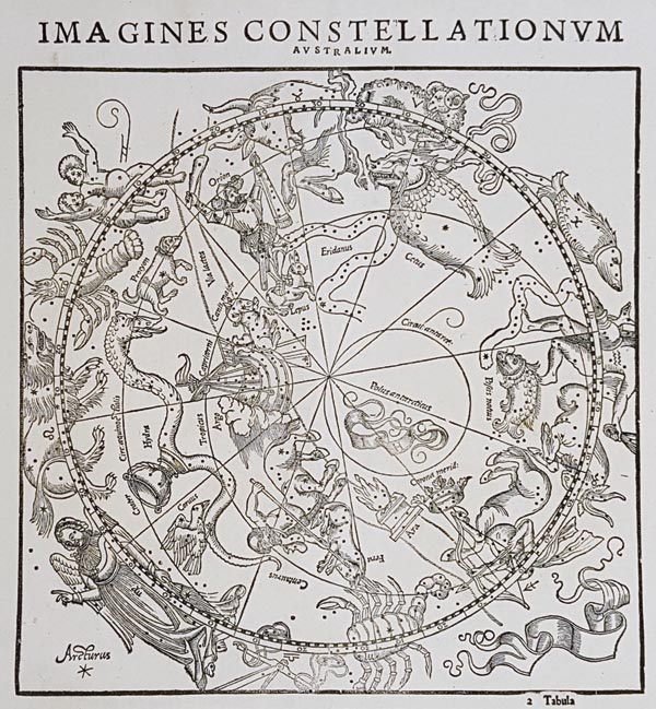
Imagines constellationum australium / Imagines constellationum borealium
1541 Bázel145. árverés / 165.
Kikiáltási ár: 550 000 Ft Leütési ár: 1 800 000 FtA déli és az északi égbolt fametszetes, Joannes Honterus által készített, kör alakú csillagtérképe. A két különálló lapot a "Claudii Ptolemaei Pelusiensis Alexandrini Omnia, quae extant, opera, Geographia excepta…" című műben adták közre. A lapok Albrecht Dürer 1515-ben megjelent (Johannes Stabius és Conrad Heinfogel csillagászok útmutatásai segítségével ábrázolt) fametszete alapján készültek, aki a 48 ptolemaioszi konstelláció mellett a korabeli csillagászati ismereteket felhasználva újabb csillagképet is ábrázolt: a Caput Meduse-t. Honterus műve egyike a legkorábbi — Dürerrel ellentétben — geocentrikus nézőpontból készített csillagtérképeknek. Az északi és a déli égboltot az ekliptika osztja ketté, amelyen a 12 állatövi jegy is megjelenik, és alkotója — az ilyen típusú térképek esetében első alkalommal — jelezte rajta az Egyenlítő, a Rák- és Baktérítő, illetve a sarkkörök helyzetét is. A déli félteke csillagászati feltérképezésének hiányából adódóan ott sokkal kevesebb csillagkép látható (a sarkköri rész teljesen üres, mivel az ókori asztronómusok által elért területekről az nem volt látható), de a művész itt is feltüntette az állatövi jegyeket, hogy a hiányosságokat elfedje kissé.
Mérete: 270 x 270 (310 x 365) mm. Hibátlan, tiszta példányok. Paszpartuban.
Fine, clear copies.
Dimensions: 270 x 270 (310 x 365) mm.

