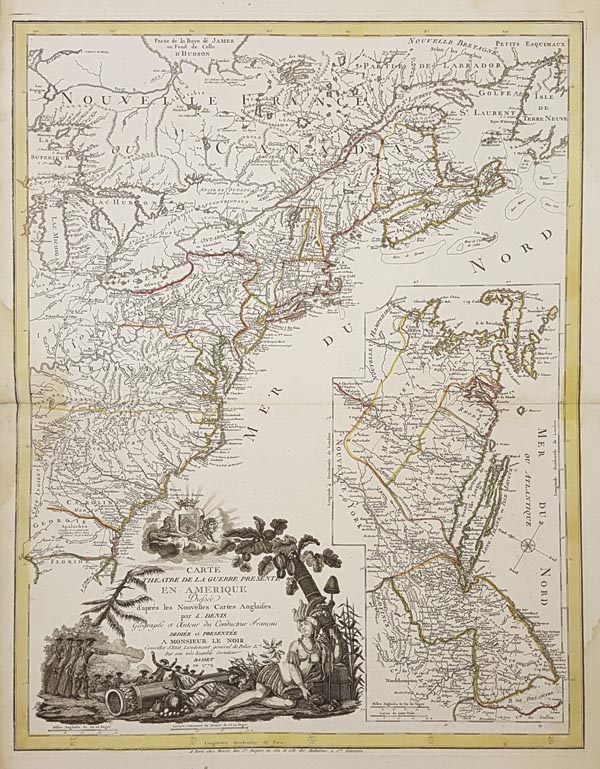
Carte du Theatre de la Guerre Presente en Amerique...
1779 Párizs143. árverés / 184.
Kikiáltási ár: 900 000 FtAz amerikai függetlenségi háború ritka, rézmetszetű térképe, amely Észak-Amerika keleti részének Új-Fundland és Észak-Florida közötti területeit mutatja be (nyugaton egészen a Michigan-tóig), kiegészítve a fő hadszínterek — New England, New York, New Jersey és Pennsylvania keleti részének — melléktérképével. A topográfiai adatok mellett nagy részletességgel tünteti fel a regionális határokat, utakat, csatatereket, erődöket, indián falvakat és területeket. A metsző által készített díszes kartus — amely felett az angol királyi címer lebeg — csatajelenetet, és — mint Amerika allegorikus megszemélyesítőjét — egy indián hercegnőt ábrázol. Önálló lapként jelent meg, André Basset kiadásában.
Mérete: 670 x 415 (780 x 550) mm.
Eredeti határszínezéssel, bal oldalon a középvonalnál vízfolttal. Paszpartuban.
Original outline colour. Waterstain on the left side at the folding.
Dimensions: 670 x 415 (780 x 550) mm.
