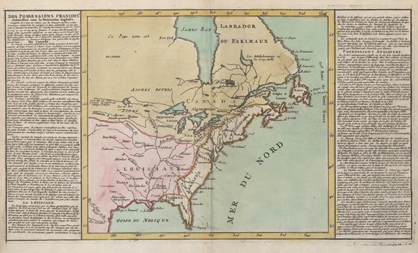
Des Possessions Francoises Aujourd'hui sous la Domination Angloises
1767 Párizs157. árverés / 167.
Kikiáltási ár: 100 000 FtAzonosító
101741
Észak-Amerika keleti részének korabeli színezésű, Jean Baptiste Louis Clouet által készített regionális térképe, amely a "Geographie Moderne" című munka első kiadásában jelent meg (a "Mer du Nord" felirat mellett még nem szerepel a későbbi állapotokon megjelenő jegyzet). A lap, amely a francia és angol fennhatóság alatt álló területeket mutatja be, a Grönland és Florida közötti régiót ábrázolja, nyugat felé pedig Új-Mexikóig nyúlik. A térképmezőt kétoldalról francia nyelvű szöveg fogja közre, amely a gyarmatok részletes leírását tartalmazza. Mérete: 320 x 555 (425 x 570) mm. Hibátlan, tiszta példány. Paszpartuban.
Regional map of North America's eastern part by Jean Baptiste Louis Clouet, published in the first edition of "Geographie Moderne" (the notation which appears in later states near "Mer du Nord" is missing). The depiction represents the French and English territories in the region between Greenland and Florida extending to the West until New Mexico. The map field is surrounded on both sides by a description in French containing a detailed account of the colonies.
Dimensions: 320 x 555 (425 x 570) mm. Fine, clear copy.
Dimensions: 320 x 555 (425 x 570) mm. Fine, clear copy.
