
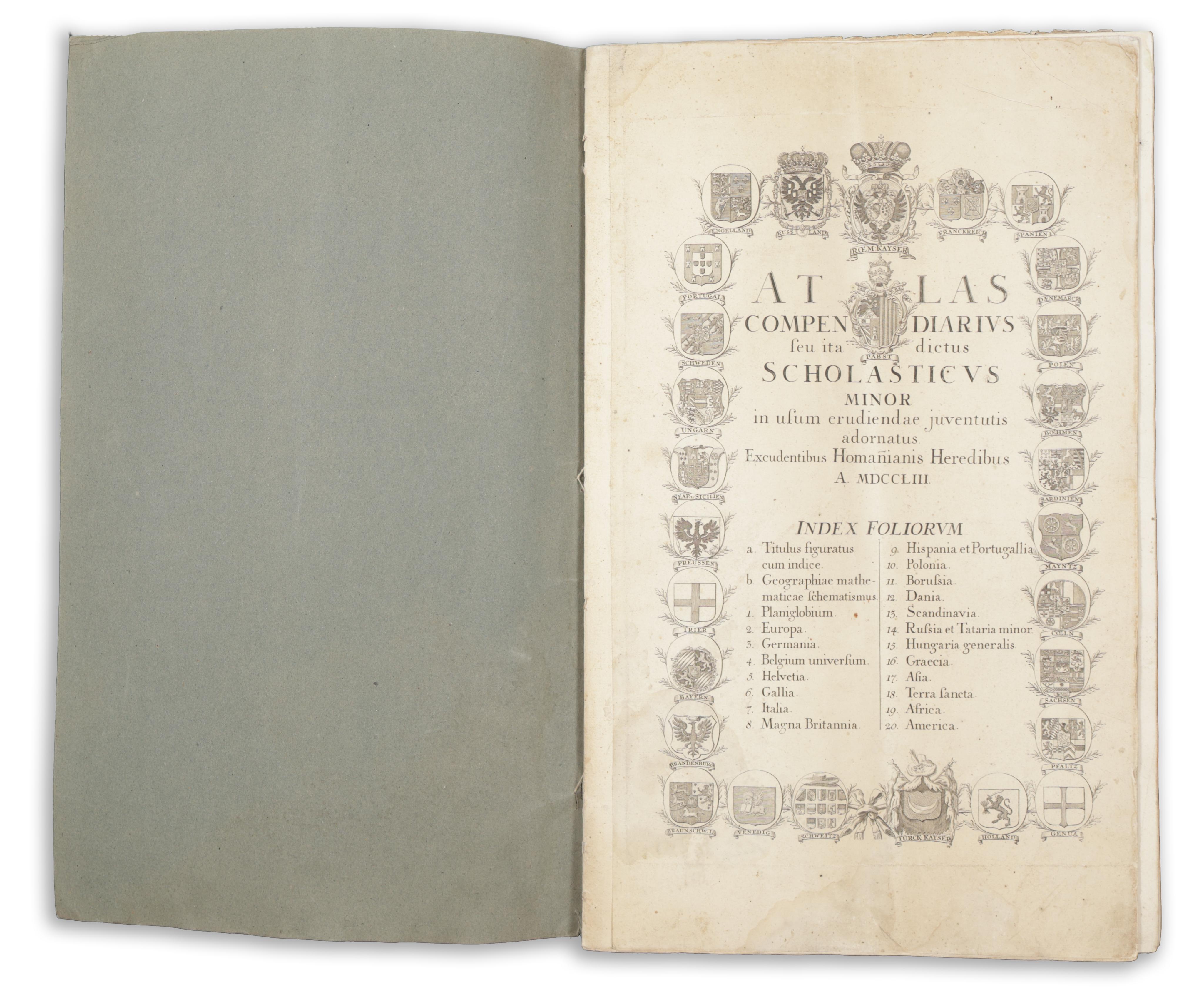
Atlas Compendiarius seu ita dictus Scholasticus Minor in ufum erudiendae juventutis adotnatus Excudentibus Homanianis Heredibus
Nuremberg, 1753. Homan. Hered.Egy kiváló példája ennek a rendkívül sikeres világatlasznak, amelyet a nürnbergi Homann örökösök adtak ki. Atlaszaik a 18. század közepének legjelentősebb kontinentális atlaszai voltak, és óriási népszerűségnek örvendtek. Rendszeresen frissítették őket, és több kiadást is megéltek, mígnem a kiadó végül 1852-ben megszűnt.
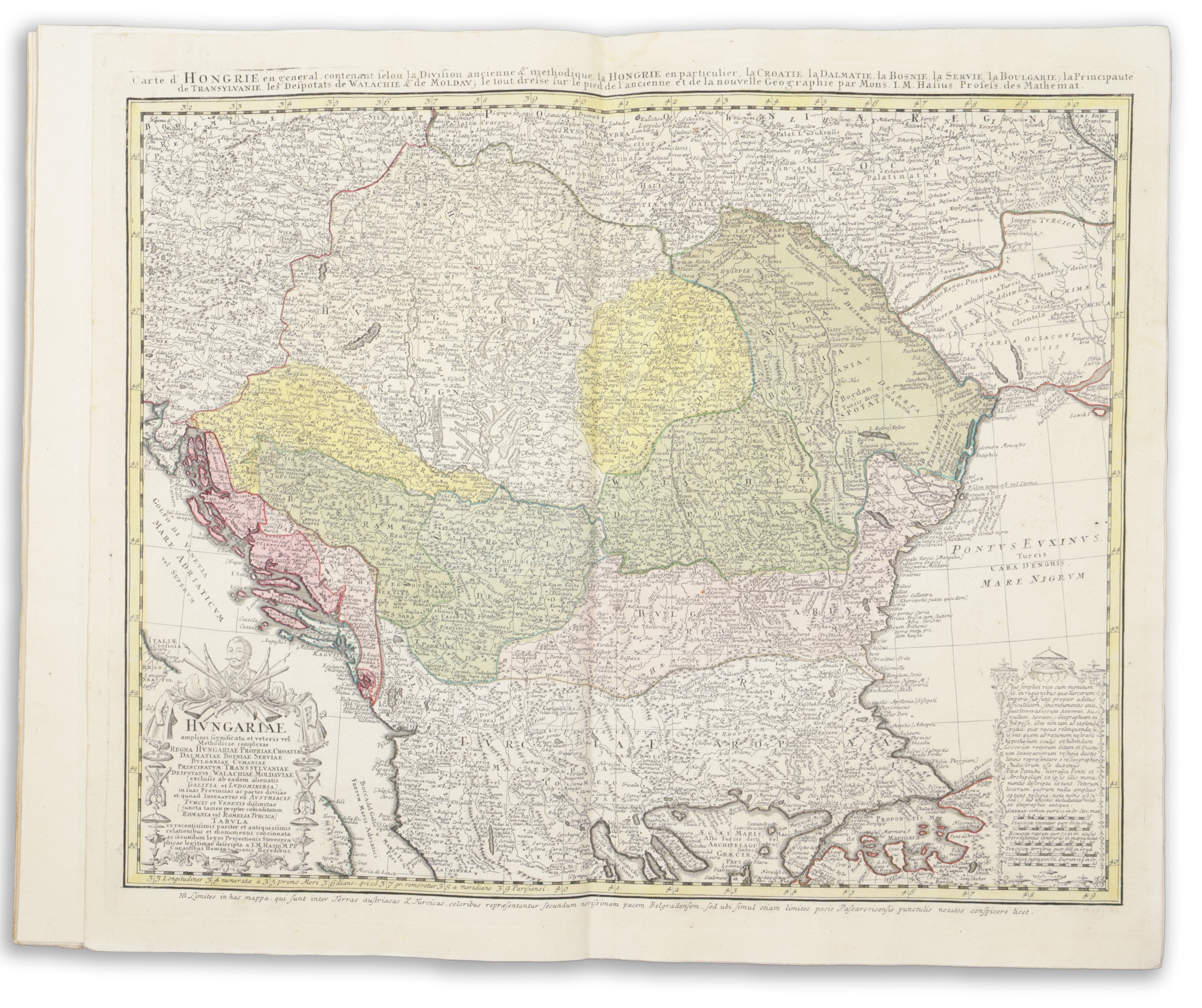
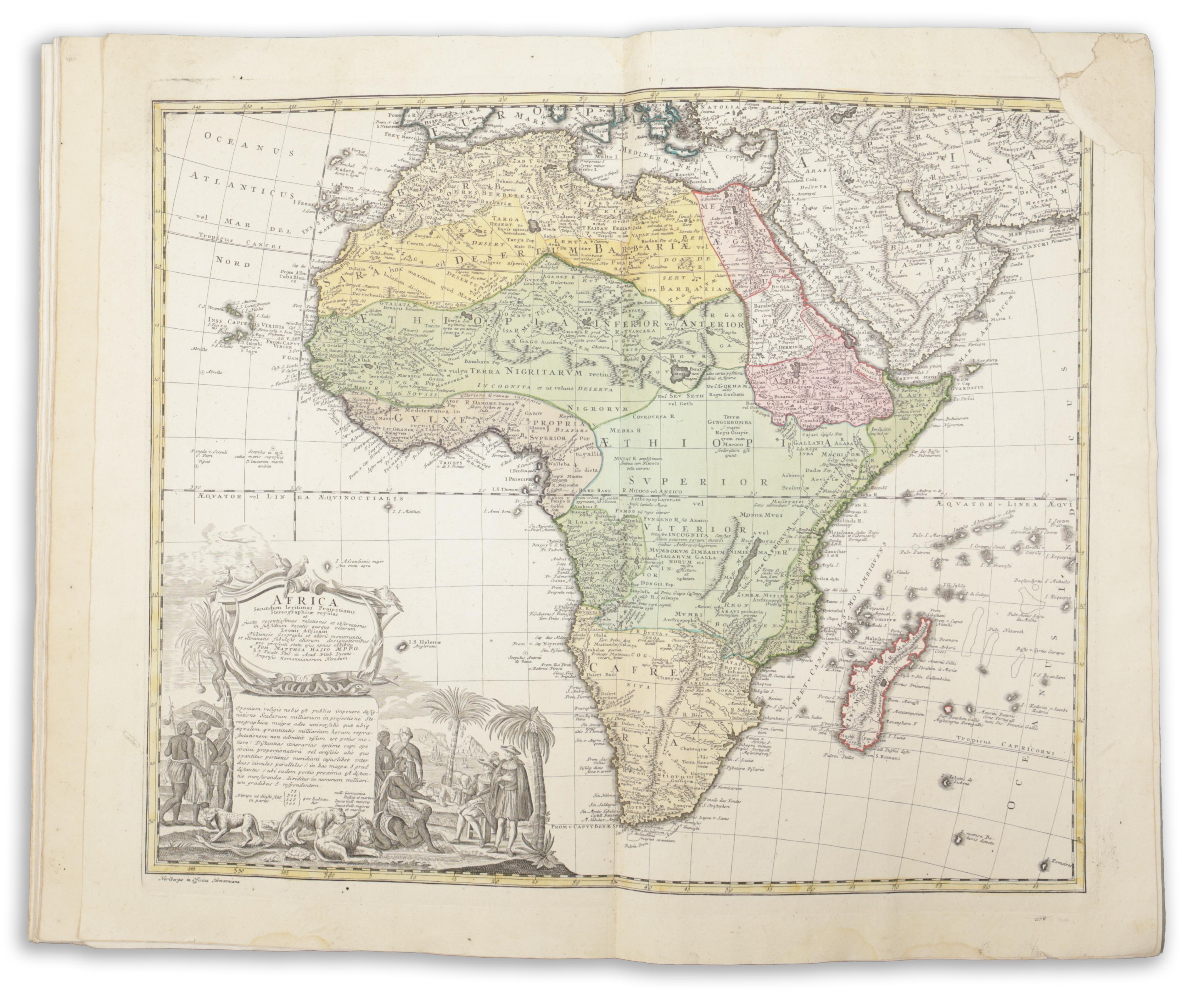
A réz-metszett díszcímlapon 28 különböző európai ország és régió címere látható. Tételünk teljes: tartalmazz egy világ térképet a félgömbökkel, valamint 20 kétoldalas, kézzel színezett rézmetszetű térképet, lenyűgöző allegorikus kartusokkal díszítve. A térképek sorrendben: Schematismus Geographiae Mathematicae, Planiglobium (világtérkép), Europa (Európa), Germania (Németország), Belgium Universum (Belgium), Helvetia (Svájc), Gallia (Franciaország), Italia (Olaszország), Magna Britannia (Nagy-Britannia), Hispania et Portugallia (Spanyolország és Portugália), Polonia (Lengyelország), Borussia (Poroszország), Dania (Dánia), Scandinavia (Skandinávia), Russia et Tataria Minor (Oroszország és Kis-Tatária), Hungaria Generalis (Magyarország), Graecia (Görögország), Asia (Ázsia), Terra Sancta (Szentföld), Africa (Afrika), America (Amerika).
Az utolsó két térkép (Afrika és Amerika) a jobb felső sarokban sérült: előbbinél a léptéket éri minimális hiány, míg utóbbinál a képmező teljesen érintetlen, a lap sarka pedig restautált. Későbbi, kopott papírborítóban, fűzve. Helyenként halvány foltokkal, melyek inkább a versokon látszanak – összességében nagyon jó állapotban.
A good example of this remarkably successful World Atlas, published by the Homann Heirs in Nuremberg. Homann's Atlases were the most important Continental atlases of the mid 18th Century and were hugely popular. They were regularly updated and went through multiple editions until the company eventually folded in 1852.
The decorative, engraved title page includes 28 coats of arms of various countries and regions of Europe. Complete with a world map with hemispheres and 20 double-page maps, all hand-coloured and engraved with impressive allegorical cartouches. The plates in order: Schematismus Geographiae Mathematicae, Planiglobium (World Map), Europa (Europe), Germania (Germany), Belgium Universum (Belgium), Helvetia (Switzerland), Gallia (France), Italia (Italy), Magna Britannia (Great Britain), Hispania et Portugallia (Spain and Portugal), Polonia (Poland), Borussia (Prussia), Dania (Denmark), Scandinavia (Scandinavia), Russia et Tataria Minor (Russia and Lesser Tartary), Hungaria Generalis (Hungary), Graecia (Greece), Asia (Asia), Terra Sancta (Holy Land), Africa (Africa), America (America).
The last two maps of Africa and America are damaged in the upper right corner, with minimal loss to the scale in the case of the former, and restored with no loss to the map field and in the case of the latter. In later worn paper covers. Some occasional, faint stains, mostly on the versos – all in all in very good condition.