

Szerző
Mercator, Gerard
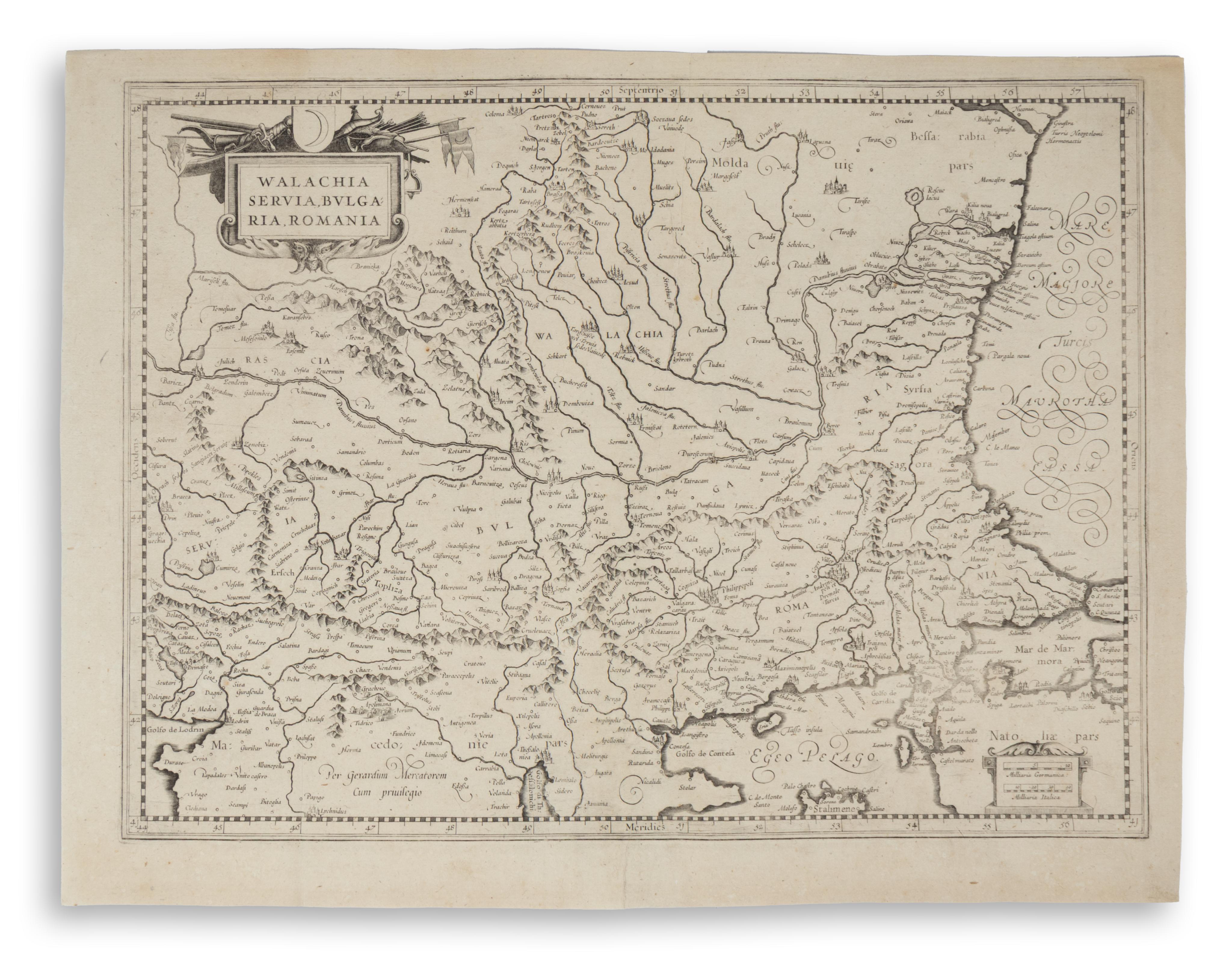
Walachia Servia, Bulgaria, Romania
Amsterdam, 1636.Ár
120 000 Ft
Azonosító
104917
A5 fiók
Látványos térkép a Kelet-Balkánról, középpontjában Bulgáriával, a Boszporusz és Konstantinápoly ábrázolásával. A térkép meghatározó eleme a Duna és vízrendszere; a terület magában foglalja Bulgáriát, Romániát, Szerbiát és Macedóniát.
Először megjelent: Mercator, Gerhard: Atlas sive Cosmographicae Meditationes de Fabrica Mundi (1545-99).
Ez Mercator első, 1589-es térképének 1636-ban frissített, katonai motívumokkal díszített, szalagdíszes címkartussal ellátott változata. A jobb alsó sarokban látható léptékjelzéseknek is eltérő a kartusa.
Mérete: 51×38,5 cm
Verso üres, restaurálás nyomaival. Ritka.
This attractive map of the Eastern Balkans is centered on Bulgaria and includes the Bosphorus and Constantinople. The Danube and its tributaries flow across the map and are the focal point, encompassing Bulgaria, Romania, Serbia, and Macedonia.
This is an updated version of the first 1589 map, which was replaced in 1636 with an updated strapwork title cartouche with a military theme. The scale cartouche is also different.
First published in: Mercator, Gerhard: Atlas sive Cosmographicae Meditationes de Fabrica Mundi (1545-99).
Size: 51×38,5 cm
Verso blank. Signs of past restoration on the verso. Rare.
This is an updated version of the first 1589 map, which was replaced in 1636 with an updated strapwork title cartouche with a military theme. The scale cartouche is also different.
First published in: Mercator, Gerhard: Atlas sive Cosmographicae Meditationes de Fabrica Mundi (1545-99).
Size: 51×38,5 cm
Verso blank. Signs of past restoration on the verso. Rare.